Area Overview for CF5 4SP
Photos of CF5 4SP
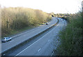
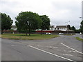
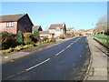
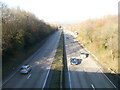

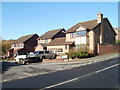
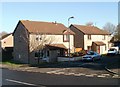
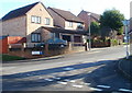
20 photos from this area
Area Information
Key information about the CF5 4SP including its size, population, and administrative classification.
- Area Type
- Postcode
- Area Size
- 2.7 hectares
- Population
- 1459
- Population Density
- 3437 people/km²
House Prices in CF5 4SP
36
Properties
£184,922
Average Sold Price
£35,500
Lowest Price
£360,000
Highest Price
Showing 36 properties
| Address | Type | Beds | Baths | Last Sale Price | Last Sale Date | |
|---|---|---|---|---|---|---|
| 23 St Fagans Court, Ely, Cardiff, CF5 4SP | Semi-detached | 4 | 2 | £285,000 | May 2024 | |
| 33 St Fagans Court, Ely, Cardiff, CF5 4SP | house | - | - | £185,000 | Jun 2023 | |
| 19 St Fagans Court, Ely, Cardiff, CF5 4SP | Semi-detached | - | - | £280,000 | Apr 2023 | |
| 12 St Fagans Court, Ely, Cardiff, CF5 4SP | house | - | - | £330,000 | Oct 2021 | |
| 11 St Fagans Court, Ely, Cardiff, CF5 4SP | house | - | - | £360,000 | Mar 2021 | |
| 3 St Fagans Court, Ely, Cardiff, CF5 4SP | Detached | 5 | 4 | £289,950 | Aug 2020 | |
| 4 St Fagans Court, Ely, Cardiff, CF5 4SP | Detached | 4 | 3 | £275,000 | Feb 2020 | |
| 15 St Fagans Court, Ely, Cardiff, CF5 4SP | Semi-detached | 4 | - | £175,000 | Sep 2013 | |
| 24 St Fagans Court, Ely, Cardiff, CF5 4SP | house | 4 | - | £163,750 | May 2012 | |
| 28 St Fagans Court, Ely, Cardiff, CF5 4SP | Semi-detached | - | - | £183,000 | Nov 2007 |
Page 1 of 4
Energy Efficiency in CF5 4SP
Amenities
Schools
| Rank | School | Type | Entry gender | Ages |
|---|
Explore more schools in this area
Go to Schools tabDemographics
Household Size
Two person
most common
Accommodation Type
Houses
most common
Tenure
81
majority
Ethnic Group
White
most common
Religion
N/A
most common
Household Composition
N/A
most common
Age
47
median
Adults (30-64 years)
most common
Household Deprivation
N/A
with no deprivation
NS-SEC
35
in Lower managerial occupations
Explore more demographic insights in this area
Go to Demographics tabPlanning
Planning Constraints
- Flood RiskPremium
- Ramsar Wetland SitesPremium
- Area of Outstanding Natural BeautyPremium
- Protected Nature ReservePremium
- Protected WoodlandPremium
- Crime RiskPremium