Area Overview for CF5 3UE
Photos of CF5 3UE


Area Information
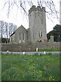
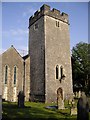
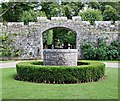
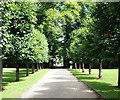
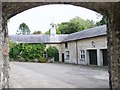
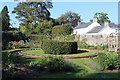
Living in CF5 3UE, a small residential postcode in Wales, means being part of a tight-knit community with a strong historical foundation. The area, covering 9,611 square metres, is home to 2,898 residents, creating a population density of 276 people per square kilometre. Its defining feature is the St Fagans National Museum of History, an open-air museum established in 1948 on the grounds of St Fagans Castle. This heritage site, with its 40 relocated historic Welsh buildings and 104 acres of woodland, anchors daily life in the area. The village’s character blends historical significance with modern convenience, offering proximity to transport links and local amenities. Residents benefit from nearby rail services, ferry stops, and retail outlets like Spar and Aldi. The median age of 47 suggests a mature community, with adults aged 30–64 forming the largest demographic. While the area’s small size limits expansion, its compact nature fosters a sense of familiarity and accessibility for those seeking a quieter, historically rich environment.
- Area Type
- Postcode
- Area Size
- 9611 m²
- Population
- 2898
- Population Density
- 276 people/km²
The property market in CF5 3UE is characterised by high home ownership, with 84% of residents living in owner-occupied homes. This suggests a predominantly stable, long-term market with limited rental activity. The accommodation type is primarily houses, indicating a focus on single-family dwellings rather than apartments or flats. Given the area’s small size and low population density, the housing stock is likely limited, with fewer new developments. This makes the market competitive for buyers seeking a home in this specific postcode. The presence of historic sites like St Fagans Castle may influence property values, with homes possibly benefiting from proximity to cultural amenities. However, the compact nature of the area means buyers must consider the limited availability of properties and the potential for slower price growth compared to larger urban centres.
House Prices in CF5 3UE
Showing 6 properties
| Address | Type | Beds | Baths | Last Sale Price | Last Sale Date | |
|---|---|---|---|---|---|---|
| Flat 1, Conifer Court, Firs Avenue, Fairwater, Cardiff, CF5 3UE | Flat | - | - | - | - | |
| Flat 3, Conifer Court, Firs Avenue, Fairwater, Cardiff, CF5 3UE | Flat | - | - | - | - | |
| Flat 2, Conifer Court, Firs Avenue, Fairwater, Cardiff, CF5 3UE | Flat | - | - | - | - | |
| Flat 5, Conifer Court, Firs Avenue, Fairwater, Cardiff, CF5 3UE | Flat | - | - | - | - | |
| Flat 6, Conifer Court, Firs Avenue, Fairwater, Cardiff, CF5 3UE | Flat | - | - | - | - | |
| Flat 4, Conifer Court, Firs Avenue, Fairwater, Cardiff, CF5 3UE | Flat | - | - | - | - |
Energy Efficiency in CF5 3UE
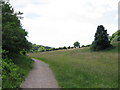
The lifestyle in CF5 3UE is shaped by its proximity to retail, transport, and cultural amenities. Local shops include Spar, Co-op Fairwater, and Aldi Treseder, providing everyday essentials within walking distance. The area’s transport links, including rail and ferry services, enhance accessibility to larger urban centres like Cardiff. The St Fagans National Museum of History offers a unique cultural draw, with its open-air exhibits and historic buildings. Parks and green spaces are not explicitly listed, but the museum’s 104 acres of woodland provide recreational opportunities. The presence of multiple rail stations and ferry stops suggests a convenient, active lifestyle, with easy access to both local and regional amenities. The mix of retail, transport, and historical sites creates a balanced environment for residents seeking both convenience and heritage.
Amenities
Schools
The nearest school to CF5 3UE is Ysgol Gynradd Groes-Wen Primary, which serves the local community. While the school’s type is listed as “other,” no specific Ofsted rating is provided in the data. The presence of a primary school within practical reach is a key consideration for families, though the lack of secondary or specialist schools nearby may require residents to travel further for higher education. The single school option suggests a smaller student population, potentially offering a more personal learning environment. However, the absence of additional schools, such as secondary institutions or special needs provision, could be a limitation for families requiring a broader range of educational options.
| Rank | School | Type | Entry gender | Ages |
|---|
Explore more schools in this area
Go to Schools tabDemographics
The community in CF5 3UE is predominantly composed of adults aged 30–64, with a median age of 47. This suggests a mature population, likely with established careers and family structures. Home ownership is high, with 84% of residents living in owner-occupied properties. The accommodation type is primarily houses, reflecting a preference for detached or semi-detached dwellings over flats. The predominant ethnic group is White, which aligns with broader trends in rural Wales. The population density of 276 people per square kilometre indicates a low-density, spread-out settlement, typical of smaller villages. This demographic profile suggests a stable, long-term resident base with limited turnover. The absence of specific deprivation data means no direct assessment of economic hardship, but the high home ownership rate and age distribution imply a relatively secure financial position for most households.
Household Size
Accommodation Type
Tenure
Ethnic Group
Religion
Household Composition
Age
Household Deprivation
NS-SEC
Explore more demographic insights in this area
Go to Demographics tabPlanning
Planning Constraints
- Flood RiskPremium
- Ramsar Wetland SitesPremium
- Area of Outstanding Natural BeautyPremium
- Protected Nature ReservePremium
- Protected WoodlandPremium
- Crime RiskPremium