Area Overview for CF5 3TY
Photos of CF5 3TY
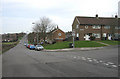
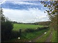
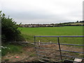
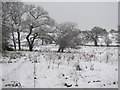
4 photos from this area
Area Information
Key information about the CF5 3TY including its size, population, and administrative classification.
- Area Type
- Postcode
- Area Size
- 1.2 hectares
- Population
- 1542
- Population Density
- 3340 people/km²
House Prices in CF5 3TY
36
Properties
£147,658
Average Sold Price
£50,000
Lowest Price
£250,000
Highest Price
Showing 36 properties
| Address | Type | Beds | Baths | Last Sale Price | Last Sale Date | |
|---|---|---|---|---|---|---|
| 16 Maple Road, Fairwater, Cardiff, CF5 3TY | Detached | 3 | 2 | £250,000 | Aug 2025 | |
| 2C Maple Road, Fairwater, Cardiff, CF5 3TY | Semi-detached | 4 | 1 | £223,500 | Jan 2022 | |
| 45 Maple Road, Fairwater, Cardiff, CF5 3TY | house | - | - | £199,950 | Oct 2021 | |
| 48 Maple Road, Fairwater, Cardiff, CF5 3TY | house | - | - | £170,000 | Aug 2021 | |
| 8 Maple Road, Fairwater, Cardiff, CF5 3TY | house | - | - | £210,000 | Jun 2021 | |
| 38 Maple Road, Fairwater, Cardiff, CF5 3TY | Terraced | 3 | 1 | £194,000 | Nov 2020 | |
| 20 Maple Road, Fairwater, Cardiff, CF5 3TY | house | - | - | £142,000 | Aug 2019 | |
| 44 Maple Road, Fairwater, Cardiff, CF5 3TY | house | - | - | £142,000 | May 2019 | |
| 46 Maple Road, Fairwater, Cardiff, CF5 3TY | Semi-detached | 2 | 1 | £140,000 | Jul 2018 | |
| 22 Maple Road, Fairwater, Cardiff, CF5 3TY | house | 2 | - | £137,000 | Jul 2016 |
Page 1 of 4
Energy Efficiency in CF5 3TY
Amenities
Schools
| Rank | School | Type | Entry gender | Ages |
|---|
Explore more schools in this area
Go to Schools tabDemographics
Household Size
Family (3-5 people)
most common
Accommodation Type
Houses
most common
Tenure
62
majority
Ethnic Group
White
most common
Religion
N/A
most common
Household Composition
N/A
most common
Age
47
median
Adults (30-64 years)
most common
Household Deprivation
N/A
with no deprivation
NS-SEC
25
in Lower managerial occupations
Explore more demographic insights in this area
Go to Demographics tabPlanning
Planning Constraints
- Flood RiskPremium
- Ramsar Wetland SitesPremium
- Area of Outstanding Natural BeautyPremium
- Protected Nature ReservePremium
- Protected WoodlandPremium
- Crime RiskPremium