Area Overview for CF5 3PQ
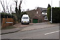
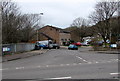
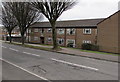
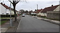
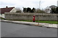
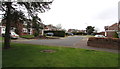
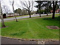
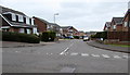
Photos of CF5 3PQ
Area Information
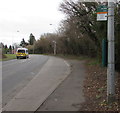
CF5 3PQ is a small, densely populated residential cluster in west Cardiff, Wales, bounded by areas such as Canton, Llandaff, and Radyr. Covering just 3,904 square metres, it is home to 1,603 residents, giving it a population density of over 410,000 people per square kilometre—a stark contrast to the typical urban sprawl. The area’s origins trace back to the 8th century, when it was gifted to Llandaff Cathedral, and it later became known as “Fairwater” from Ecclesiastical Latin *bella aqua* (“fair water”). Today, it is a suburban community with a mix of historic and modern features, including Fairwater Green, a hub for independent shops, and The Dell, a public park notable for its early manmade ski slope. The area’s character is shaped by its proximity to Cardiff’s cultural and commercial centres, with easy access to rail, ferry, and bus networks. Its compact size means residents are close to amenities, schools, and green spaces, though the high density underscores its role as a tightly knit neighbourhood rather than a sprawling suburb.
- Area Type
- Postcode
- Area Size
- 3904 m²
- Population
- 1603
- Population Density
- 3490 people/km²
CF5 3PQ is a small area with a housing stock dominated by houses rather than flats, which is uncommon for its high density. With 46% of residents owning their homes, the market is a blend of owner-occupied properties and rentals. The compact size of the area means housing choices are limited, and buyers should consider proximity to nearby suburbs for more options. The presence of schools and transport links may influence property values, as these are key factors for families. However, the lack of data on property prices or recent developments means potential buyers must assess the area’s suitability based on its amenities and connectivity. The mix of home ownership and rental properties suggests a community where both long-term residents and renters coexist, though the high density could lead to competition for available homes.
House Prices in CF5 3PQ
Showing 13 properties
| Address | Type | Beds | Baths | Last Sale Price | Last Sale Date | |
|---|---|---|---|---|---|---|
| 47 Ash Place, Fairwater, Cardiff, CF5 3PQ | house | 3 | - | £245,000 | Oct 2024 | |
| 43 Ash Place, Fairwater, Cardiff, CF5 3PQ | house | - | - | £165,000 | Dec 2018 | |
| 48 Ash Place, Fairwater, Cardiff, CF5 3PQ | Terraced | 3 | - | £125,000 | May 2014 | |
| 42 Ash Place, Fairwater, Cardiff, CF5 3PQ | house | 3 | - | £100,000 | Mar 2012 | |
| 49 Ash Place, Fairwater, Cardiff, CF5 3PQ | house | - | - | £95,000 | Jan 2012 | |
| 51 Ash Place, Fairwater, Cardiff, CF5 3PQ | house | - | - | £120,000 | Dec 2005 | |
| 52 Ash Place, Fairwater, Cardiff, CF5 3PQ | house | - | - | £102,000 | May 2004 | |
| 50 Ash Place, Fairwater, Cardiff, CF5 3PQ | house | - | - | £49,000 | Apr 1999 | |
| 44 Ash Place, Fairwater, Cardiff, CF5 3PQ | house | - | - | - | - | |
| 53 Ash Place, Fairwater, Cardiff, CF5 3PQ | house | - | - | - | - |
Energy Efficiency in CF5 3PQ
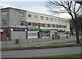
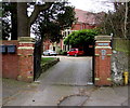
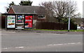
Residents of CF5 3PQ have access to a range of amenities within practical reach. Retail options include Spar, Co-op Fairwater, and Asda Llantrisant, providing everyday shopping needs. The area’s recreational spaces include The Dell, a public park with a historic ski slope, and Fairwater Green, a hub for independent shops and community activities. The Fairwater Community Campus brings together schools, sports facilities, and community spaces, supporting both educational and leisure needs. Nearby, the Waterhall Estate’s legacy is visible in local landmarks like Ty Bronna, a Grade II listed building. The compact size of the area ensures that residents can walk or cycle to most amenities, fostering a convenient, connected lifestyle.
Amenities
Schools
The nearest school to CF5 3PQ is Cantonian High School, which operates as a mixed secondary school. While the data does not provide an Ofsted rating, its presence indicates access to secondary education for local families. The school’s location within the area means students can attend without long commutes, though the absence of primary schools or other educational institutions in the immediate vicinity may require families to seek options in nearby suburbs like Canton or Llandaff. The mix of school types—primarily secondary education—suggests a focus on older children, which aligns with the area’s median age. For families requiring a full range of educational services, additional research into nearby primary schools and alternative providers would be necessary.
| Rank | School | Type | Entry gender | Ages |
|---|
Explore more schools in this area
Go to Schools tabDemographics
The population of CF5 3PQ is predominantly adults aged 30–64, with a median age of 47. This suggests a community of middle-aged residents, many of whom may be in their prime working years or raising families. Home ownership stands at 46%, indicating a mix of owner-occupied properties and rental housing. The area is characterised by houses rather than flats, which is unusual for a high-density postcode. The predominant ethnic group is White, reflecting broader trends in the region. While specific data on deprivation is absent, the high population density and focus on single-family homes may imply a balance between affordability and space. The age profile suggests a stable, established community, though the lack of younger demographics could affect local services and schools.
Household Size
Accommodation Type
Tenure
Ethnic Group
Religion
Household Composition
Age
Household Deprivation
NS-SEC
Explore more demographic insights in this area
Go to Demographics tabPlanning
Planning Constraints
- Flood RiskPremium
- Ramsar Wetland SitesPremium
- Area of Outstanding Natural BeautyPremium
- Protected Nature ReservePremium
- Protected WoodlandPremium
- Crime RiskPremium