Area Overview for CF5 2PT
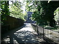
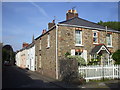
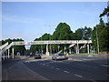
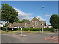
Photos of CF5 2PT
Area Information
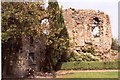
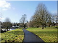
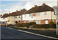
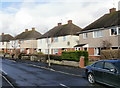
Living in CF5 2PT means being part of a tightly knit residential cluster in the north of Cardiff, Wales. This postcode area spans just 6 hectares, yet it hosts 1,623 residents, creating a high population density of 27,132 people per square kilometre. The area retains a village-like character, rooted in its historical significance as a religious and administrative hub. Llandaff, the broader district encompassing CF5 2PT, is home to Llandaff Cathedral, a 12th-century structure with ties to the Bishop of Llandaff. Daily life here blends suburban convenience with historical depth, with residents enjoying proximity to retail, transport, and cultural landmarks. The area’s compact size means amenities are within walking or short transit distance, while its integration into Cardiff offers access to the city’s broader networks. For those seeking a balance between residential tranquillity and urban connectivity, CF5 2PT offers a distinct blend of heritage and modernity.
- Area Type
- Postcode
- Area Size
- 6.0 hectares
- Population
- 1623
- Population Density
- 3000 people/km²
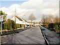
The property market in CF5 2PT is characterised by high home ownership (82%) and a predominance of houses as the primary accommodation type. This indicates a market skewed towards owner-occupiers rather than renters, suggesting stability and long-term investment in the area. Given the small size of the postcode area (6 hectares) and its high population density, the housing stock is likely compact, with properties designed for family living. Buyers should consider that the surrounding neighbourhoods may share similar characteristics, offering a mix of traditional and modern homes. The high home ownership rate implies strong community ties and potentially limited rental availability, making it a less attractive option for those seeking short-term lets. For those prioritising property value and a settled lifestyle, CF5 2PT’s market reflects a focus on permanence and local connection.
House Prices in CF5 2PT
Showing 15 properties
| Address | Type | Beds | Baths | Last Sale Price | Last Sale Date | |
|---|---|---|---|---|---|---|
| 3 Bridge Road, Llandaff, Cardiff, CF5 2PT | house | - | - | £310,000 | Oct 2022 | |
| 7 Bridge Road, Llandaff, Cardiff, CF5 2PT | house | 2 | - | £287,000 | Dec 2020 | |
| 5 Bridge Road, Llandaff, Cardiff, CF5 2PT | house | 2 | - | £262,000 | Dec 2020 | |
| 14 Bridge Road, Llandaff, Cardiff, CF5 2PT | Semi-detached | 3 | 1 | £359,995 | Oct 2019 | |
| 12 Bridge Road, Llandaff, Cardiff, CF5 2PT | house | - | - | £360,000 | Sep 2019 | |
| 18 Bridge Road, Llandaff, Cardiff, CF5 2PT | house | - | - | £355,000 | Oct 2018 | |
| 1 Bridge Road, Llandaff, Cardiff, CF5 2PT | Detached | 5 | 1 | £250,000 | Feb 2012 | |
| 6 Bridge Road, Llandaff, Cardiff, CF5 2PT | house | - | - | £250,000 | Nov 2008 | |
| 4 Bridge Road, Llandaff, Cardiff, CF5 2PT | house | - | - | £260,000 | Aug 2005 | |
| 2 Bridge Road, Llandaff, Cardiff, CF5 2PT | Semi-detached | 3 | - | £161,000 | May 2001 |
Energy Efficiency in CF5 2PT
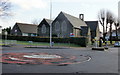
Residents of CF5 2PT have access to a range of amenities within practical reach. Retail options include Lidl Whitchurch, Spar, and Asda Llantrisant, providing everyday shopping convenience. The area’s rail stations, such as Danescourt and Fairwater, and ferry stops like Taffs Mead Waterbus Stop, ensure easy access to Cardiff’s cultural and commercial hubs. The Cardiff Bus Interchange further enhances connectivity, linking the area to broader networks. While the postcode’s small size limits the diversity of leisure options, its proximity to Llandaff’s historic sites, such as Llandaff Cathedral and Insole Court, offers cultural enrichment. The village-like atmosphere, combined with these amenities, creates a lifestyle that balances suburban comfort with urban accessibility. Daily life here is shaped by a mix of local convenience and the opportunity to explore Cardiff’s broader offerings.
Amenities
Schools
The nearest school to CF5 2PT is Ysgol Pencae, which is categorised as an “other” type in the data. No further details about its Ofsted rating or educational focus are provided. Families relying solely on local schools may need to consider additional options beyond CF5 2PT, as the area’s small size limits the range of educational institutions. The presence of a single school suggests that parents might look to nearby postcodes or broader Cardiff for secondary or specialist provisions. However, the proximity of Llandaff’s historical and cultural assets, such as Howell’s School for Girls, could offer supplementary educational or enrichment opportunities. For families prioritising school choice, the area’s limited school infrastructure may necessitate careful planning.
| Rank | School | Type | Entry gender | Ages |
|---|
Explore more schools in this area
Go to Schools tabDemographics
The community in CF5 2PT is predominantly composed of adults aged 30–64, with a median age of 47. This suggests a mature, established population, likely with long-term ties to the area. Home ownership is high at 82%, reflecting a stable, owner-occupied demographic. The accommodation type is primarily houses, indicating a preference for single-family homes over flats or apartments. The predominant ethnic group is White, aligning with broader trends in the region. With 1,623 residents in such a small area, the population density is exceptionally high, which may influence local services and social dynamics. This profile suggests a community focused on long-term living, with residents prioritising property ownership and a settled lifestyle. The absence of specific deprivation data means the area’s quality of life is inferred from its infrastructure and amenities, which appear robust.
Household Size
Accommodation Type
Tenure
Ethnic Group
Religion
Household Composition
Age
Household Deprivation
NS-SEC
Explore more demographic insights in this area
Go to Demographics tabPlanning
Planning Constraints
- Flood RiskPremium
- Ramsar Wetland SitesPremium
- Area of Outstanding Natural BeautyPremium
- Protected Nature ReservePremium
- Protected WoodlandPremium
- Crime RiskPremium