Area Overview for CF5 2DX
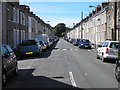
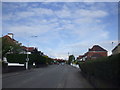
Photos of CF5 2DX
Area Information
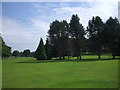
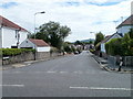
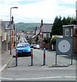
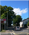
Living in CF5 2DX means residing within Llandaff, a distinct district in the north of Cardiff. This postcode cluster occupies exactly 6,015 square metres, forming a tightly knit residential environment. The area has a population of 1,667 people, which creates a high density reflecting its established village character. Despite its small physical footprint, the location offers a deep sense of history. Llandaff derives its name from the Welsh word for church on the River Taff, reflecting its origins as a Christian place of worship since the 6th century. The modern settlement was incorporated into Cardiff on 9 November 1922. You live in a community that retains a clean, green, and up-market countrified feel while functioning as an attractive suburb. The area is centred around significant religious sites and the historic seat of the Bishop of Llandaff. Improvements made by the Insole family over coal trading and educational funding by Thomas Howell shaped the neighbourhood's current identity. The combination of a specific village atmosphere and proximity to the city capital makes this postcode a practical choice for residents seeking stability and heritage. The compact nature of the area ensures that distances to key local features are very short for daily life.
- Area Type
- Postcode
- Area Size
- 6015 m²
- Population
- 1667
- Population Density
- 2473 people/km²
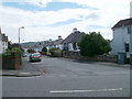
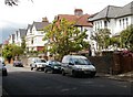
The property market in CF5 2DX is defined by a strong preference for ownership. With 70% of houses in the area owned by residents, this cluster operates as a predominantly owner-occupied zone rather than a private rental market. This statistic contrasts sharply with many modern developments where investors dominate the housing stock. The accommodation type is exclusively described as houses, meaning you will find a range of terraced, semi-detached, and detached properties rather than modern flats or apartments. Purchasing homes here offers the stability associated with freehold titles and established neighbourhoods. The concentration of ownership indicates that fewer properties are available for quick rental turnover, meaning sales take longer but tend to remain with families. The 1,667 residents spread across this small footprint create a competitive but stable local market. Buyers looking for chaingleader properties or first-time buyers may find the market constrained by the limited number of distinct buildings within the 6,015 square metre boundary. The local market reflects the historic wealth of Llandaff, where properties often hold value based on their age and provenance rather than rapid development.
House Prices in CF5 2DX
Showing 9 properties
| Address | Type | Beds | Baths | Last Sale Price | Last Sale Date | |
|---|---|---|---|---|---|---|
| 11 HIGH STREET, Llandaff, Cardiff, CF5 2DX | Semi-detached | - | - | - | - | |
| First Floor, St Andrews, 1 High Street, Llandaff, Cardiff, CF5 2DX | Flat | - | - | - | - | |
| Ground Floor, St Andrews, 1 High Street, Llandaff, Cardiff, CF5 2DX | Semi-detached | 4 | 2 | - | - | |
| Flat 2, St Cross, 3 High Street, Llandaff, Cardiff, CF5 2DX | Flat | - | - | - | - | |
| 11A High Street, Llandaff, Cardiff, CF5 2DX | undefined | - | - | - | - | |
| Flat 1, St Cross, 3 High Street, Llandaff, Cardiff, CF5 2DX | Flat | - | - | - | - | |
| 7 High Street, Llandaff, Cardiff, CF5 2DX | Detached | - | - | - | - | |
| St Andrews, 1 High Street, Llandaff, Cardiff, CF5 2DX | Semi-detached | - | - | - | - | |
| St Cross, 3 High Street, Llandaff, Cardiff, CF5 2DX | Semi-detached | - | - | - | - |
Energy Efficiency in CF5 2DX
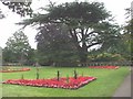
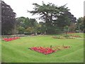
Your daily lifestyle in CF5 2DX revolves around a mix of local retail and exceptional transport links. There are five retail outlets within practical reach, including a Spar, Co-op Cardiff, and a second Spar branch. These shops provide the essentials without requiring long trips to the city centre. Five rail stations nearby ensure you can travel easily, while five ferry options allow you to access the waterways around Cardiff. The Cardiff Bus Interchange is located nearby, serving as a major hub for bus services. Beyond shopping, you can access leisure and cultural activities through the extensive transport network. The area is close to the Llandaff Cathedral and Howell's School, serving as anchors for the local character. The presence of BBC Wales Broadcasting House in the broader vicinity adds to the cultural richness of the surrounding neighbourhood. You live in an area where historical landmarks like the Jasper Tower and Insole Court shape the streetscape. The village atmosphere means you can park near your home and walk to shops or stations with ease. This blend of local convenience and city proximity defines the freedom of living in CF5 2DX.
Amenities
Schools
Families in CF5 2DX have access to two notable educational institutions nearby. The Cathedral School operates near the residential cluster and falls under the other school category description within the dataset. Howell's School also serves the area and is the type of other school listed for students in this postcode. These institutions provide secondary education options for those living within the immediate vicinity. The presence of these specific schools suggests a focus on established educational traditions, particularly given Howell's School's reputation as the oldest independent all-girls school in Wales. You do not have to travel far to find educational facilities that support your children's development. The mix of school types allows you to consider options that suit different academic or religious preferences. Parents living in this area benefit from the proximity of these named schools, reducing commute times for morning and afternoon runs. The specific listing of these institutions confirms that educational support is a tangible feature of the neighbourhood surrounding your home.
| Rank | School | Type | Entry gender | Ages |
|---|
Explore more schools in this area
Go to Schools tabDemographics
The community in CF5 2DX has a mature demographic profile characterised by a median age of 47. Adults aged between 30 and 64 years form the most common age range within this population. Home ownership stands at 70%, indicating that the majority of residents have purchased their properties rather than renting. This high level of ownership suggests a settled community where most households have long-term ties to the locality. Accommodation types consist primarily of detached or semi-detached houses, creating a uniform residential streetscape. The predominant ethnic group in this cluster is White, mirroring the wider demographic patterns of the city's older suburbs. The population density reaches 277,135 people per square kilometre due to the very small land area of the postcode. Such density means narrow streets and close proximity between buildings, contributing to the intimate village atmosphere. You are surrounded by neighbours in a setting where the sense of community is reinforced by shared local institutions. The age profile suggests active adults who likely manage a settled household close to retirement or with young families.
Household Size
Accommodation Type
Tenure
Ethnic Group
Religion
Household Composition
Age
Household Deprivation
NS-SEC
Explore more demographic insights in this area
Go to Demographics tabPlanning
Planning Constraints
- Flood RiskPremium
- Ramsar Wetland SitesPremium
- Area of Outstanding Natural BeautyPremium
- Protected Nature ReservePremium
- Protected WoodlandPremium
- Crime RiskPremium