Area Overview for CF5 1QJ
Photos of CF5 1QJ

Area Information
CF5 1QJ is a small residential cluster in Cardiff, Wales, nestled within a 1,686-metre² area that supports a population of 1,454 people. This postcode area, part of the broader Canton district, reflects a suburban character shaped by its historical roots as an agricultural hub. Today, it blends traditional housing with modern amenities, offering a mix of shops, parks, and community spaces. The area is defined by its proximity to the River Taff, which provides scenic walking and cycling routes, and its integration into Cardiff’s transport network. Residents benefit from a tightly knit community, with a median age of 47 and a population skewed toward adults aged 30–64. The area’s compact size means most amenities are within practical reach, including retail outlets, rail stations, and ferry stops. Canton’s history as a market town and its role in Cardiff’s industrial past contribute to a sense of local identity, while its current appeal lies in affordability, accessibility, and the balance between suburban tranquillity and urban connectivity.
- Area Type
- Postcode
- Area Size
- 1686 m²
- Population
- 1454
- Population Density
- 8405 people/km²
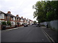
CF5 1QJ is primarily an owner-occupied area, with 62% of homes owned by residents rather than rented. The accommodation type is predominantly houses, which is typical of suburban settings and suggests a focus on family homes and larger living spaces. This contrasts with areas dominated by rental properties or flats, where turnover might be higher. The high home ownership rate indicates a stable market, with residents likely to remain in the area long-term. Given the postcode’s small size, the housing stock is limited but concentrated, making it a niche market for buyers seeking established properties in a compact, well-connected location. The presence of houses rather than flats may appeal to those prioritising private outdoor space and traditional layouts. However, the area’s small footprint means buyers should consider immediate surroundings for additional options.
House Prices in CF5 1QJ
Showing 11 properties
| Address | Type | Beds | Baths | Last Sale Price | Last Sale Date | |
|---|---|---|---|---|---|---|
| 5 Parry Street, Canton, Cardiff, CF5 1QJ | Terraced | 2 | - | £337,500 | Jul 2023 | |
| 9 Parry Street, Canton, Cardiff, CF5 1QJ | Terraced | 2 | - | £189,500 | Feb 2014 | |
| 7 Parry Street, Canton, Cardiff, CF5 1QJ | Terraced | 3 | 1 | £170,000 | Aug 2011 | |
| 3 Parry Street, Canton, Cardiff, CF5 1QJ | Terraced | 2 | 1 | £195,000 | Dec 2006 | |
| 1 Parry Street, Canton, Cardiff, CF5 1QJ | house | 2 | 1 | £129,950 | Dec 2003 | |
| 6 Parry Street, Canton, Cardiff, CF5 1QJ | Terraced | - | - | £49,500 | Nov 1996 | |
| 4 Parry Street, Canton, Cardiff, CF5 1QJ | Terraced | - | - | £48,500 | Sep 1996 | |
| 2 Parry Street, Canton, Cardiff, CF5 1QJ | Terraced | - | - | - | - | |
| 10 Parry Street, Canton, Cardiff, CF5 1QJ | house | - | - | - | - | |
| 12 Parry Street, Canton, Cardiff, CF5 1QJ | house | - | - | - | - |
Energy Efficiency in CF5 1QJ
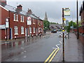
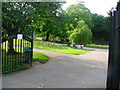
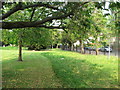
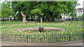
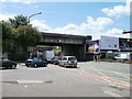
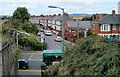
CF5 1QJ’s residents have access to a range of amenities within walking or short driving distance. Retail options include Iceland Canton, Co-op Canton, and Co-op Cardiff, providing everyday essentials. The area’s rail and ferry links, such as Ninian Park Railway Station and Taffs Mead Waterbus Stop, offer easy access to Cardiff’s cultural and commercial hubs. For leisure, the River Taff’s paths are ideal for walking or cycling, while the historic Canton Cross and local parks provide green spaces. The community is further enriched by venues like the Canton Rugby Club and Canton Community Hall, which host events and workshops. The proximity to Cardiff’s city centre, combined with local shops and transport, creates a lifestyle that balances suburban comfort with urban opportunities.
Amenities
Schools
The nearest school to CF5 1QJ is Radnor Primary School, categorised as an ‘other’ type in the data. While no Ofsted rating is provided, the school’s presence suggests accessibility for families in the area. The absence of secondary schools or additional primary schools in the immediate vicinity may require residents to travel slightly further for comprehensive education. However, the area’s proximity to Cardiff’s broader network—such as the River Taff and major roads—could facilitate commuting to larger schools in nearby districts. The lack of detailed school data means potential buyers should verify current educational offerings, though the existing primary school indicates a baseline level of local provision.
| Rank | School | Type | Entry gender | Ages |
|---|
Explore more schools in this area
Go to Schools tabDemographics
CF5 1QJ’s population of 1,454 is predominantly composed of adults aged 30–64, with a median age of 47. This suggests a mature, stable community with a focus on established households. Home ownership is high, at 62%, indicating a strong presence of long-term residents. The area is characterised by houses rather than flats, reflecting a preference for family-friendly, single-unit living. The predominant ethnic group is White, though the area’s historical ties to immigration—particularly Irish in the 19th century—hint at a diverse heritage. While specific deprivation data is not provided, the high home ownership rate and proximity to amenities suggest a relatively stable quality of life. The population density of 862,568 people per square kilometre is unusually high for a residential area, which may influence local dynamics, though it aligns with the compact, clustered nature of the postcode.
Household Size
Accommodation Type
Tenure
Ethnic Group
Religion
Household Composition
Age
Household Deprivation
NS-SEC
Explore more demographic insights in this area
Go to Demographics tabPlanning
Planning Constraints
- Flood RiskPremium
- Ramsar Wetland SitesPremium
- Area of Outstanding Natural BeautyPremium
- Protected Nature ReservePremium
- Protected WoodlandPremium
- Crime RiskPremium