Area Overview for CF5 1NT
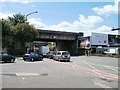
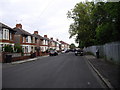
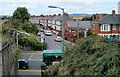
Photos of CF5 1NT

Area Information
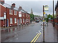
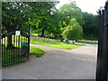
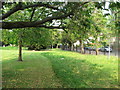
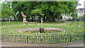
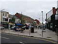
CF5 1NT lies in the heart of Canton, a suburban district of Cardiff, Wales, known for its blend of historical roots and modern convenience. The area covers 3,958 square metres and is home to 1,728 residents, making it a densely populated yet compact community. Canton’s character is shaped by its proximity to the River Taff, with paths along its banks offering scenic routes for walking or cycling. Originally an agricultural hub, the area transformed during the 19th century with industrial growth and immigration, leaving a legacy of community spirit and cultural diversity. Today, it thrives as a mix of traditional and contemporary amenities, from local markets to modern retail. The postcode is part of a civil parish with strong local ties, where residents enjoy a family-friendly environment and bilingual Welsh-English interactions. With excellent transport links to Cardiff’s city centre and beyond, CF5 1NT balances suburban tranquillity with urban accessibility. Its small-scale nature means the area feels close-knit, with a focus on community events and local institutions like the Canton Rugby Club and Corp Market.
- Area Type
- Postcode
- Area Size
- 3958 m²
- Population
- 1728
- Population Density
- 12128 people/km²
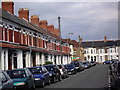
The property market in CF5 1NT is dominated by owner-occupied homes, with 65% of residents living in their own properties. The accommodation type is primarily houses, reflecting the suburban nature of the area and its appeal to families seeking space and privacy. This contrasts with urban areas where flats are more common, indicating a preference for single-family homes in Canton. The small area size and high population density suggest limited housing stock, meaning buyers may need to consider nearby postcode areas for additional options. The predominance of houses also implies a focus on long-term residency rather than short-term rental properties, which could influence property values and demand. For homebuyers, the market offers a mix of traditional and modern housing, with proximity to Cardiff’s city centre providing access to employment opportunities. However, the compact nature of CF5 1NT means competition for properties may be fierce, requiring buyers to act decisively when opportunities arise.
House Prices in CF5 1NT
Showing 29 properties
| Address | Type | Beds | Baths | Last Sale Price | Last Sale Date | |
|---|---|---|---|---|---|---|
| 43 Alexandra Road, Canton, Cardiff, CF5 1NT | Terraced | 3 | 1 | £210,000 | Nov 2023 | |
| 31 Alexandra Road, Canton, Cardiff, CF5 1NT | Terraced | 3 | 1 | £235,000 | Oct 2023 | |
| 55 Alexandra Road, Canton, Cardiff, CF5 1NT | Terraced | 3 | 1 | £300,000 | Jun 2023 | |
| 41 Alexandra Road, Canton, Cardiff, CF5 1NT | Terraced | 3 | 1 | £250,000 | Dec 2021 | |
| 61 Alexandra Road, Canton, Cardiff, CF5 1NT | Terraced | 3 | 1 | £288,000 | Mar 2020 | |
| 63 Alexandra Road, Canton, Cardiff, CF5 1NT | Terraced | 3 | 1 | £295,000 | Jan 2020 | |
| 45 Alexandra Road, Canton, Cardiff, CF5 1NT | Terraced | 3 | 1 | £263,000 | Dec 2018 | |
| 37 Alexandra Road, Canton, Cardiff, CF5 1NT | Terraced | 1 | 1 | £239,000 | Nov 2017 | |
| 57 Alexandra Road, Canton, Cardiff, CF5 1NT | Terraced | 3 | 1 | £222,000 | Dec 2016 | |
| 79 Alexandra Road, Canton, Cardiff, CF5 1NT | house | - | - | £173,000 | Jan 2014 |
Energy Efficiency in CF5 1NT
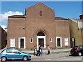
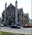
Living in CF5 1NT offers a vibrant mix of retail, dining, and community amenities. The area’s five retail outlets include Co-op Canton, Tesco Canton, and Iceland Canton, providing everyday essentials within easy reach. For leisure, the River Taff paths are ideal for walking or cycling, while the historic Corp Market hosts local vendors and community events. Cultural and social hubs include the Canton Rugby Club, Canton Uniting Church, and Canton Community Hall, which host workshops and gatherings. Schools like Cantonian High School and Canton Primary School are prominent, supporting families with educational needs. The area’s proximity to Cardiff’s city centre means residents can access larger shopping, dining, and entertainment options without lengthy commutes. The presence of multiple railway stations and ferry stops enhances convenience, allowing easy travel to Cardiff’s landmarks and beyond. This blend of local amenities and urban connectivity creates a lifestyle that balances suburban comfort with city opportunities.
Amenities
Schools
| Rank | School | Type | Entry gender | Ages |
|---|
Explore more schools in this area
Go to Schools tabDemographics
The population of CF5 1NT is 1,728, with a median age of 47 and the majority of residents aged 30–64. This suggests a community skewed toward middle-aged adults, likely reflecting a mix of long-term residents and those drawn to the area’s amenities. Home ownership stands at 65%, indicating a stable housing market where most residents live in their own homes. The predominant accommodation type is houses, which aligns with the suburban character of the area. The predominant ethnic group is White, though the data does not specify further diversity metrics. The high population density of 436,559 people per square kilometre highlights the compact nature of the area, which may influence local services and infrastructure. While no deprivation data is provided, the presence of 5 retail outlets, including Co-op and Tesco, and multiple transport links suggests accessibility to essential services. The age profile and ownership rates suggest a community prioritising stability and family-oriented living, with a strong emphasis on local institutions and traditions.
Household Size
Accommodation Type
Tenure
Ethnic Group
Religion
Household Composition
Age
Household Deprivation
NS-SEC
Explore more demographic insights in this area
Go to Demographics tabPlanning
Planning Constraints
- Flood RiskPremium
- Ramsar Wetland SitesPremium
- Area of Outstanding Natural BeautyPremium
- Protected Nature ReservePremium
- Protected WoodlandPremium
- Crime RiskPremium