Area Overview for CF5 1GH
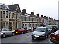
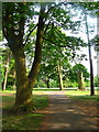
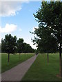
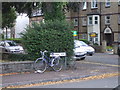
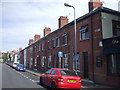
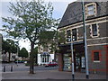
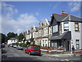
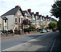
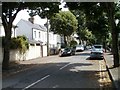
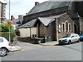
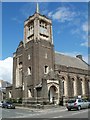
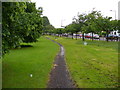
Photos of CF5 1GH
Area Information
CF5 1GH is a small residential cluster in Cardiff, Wales, with a population of 1,552 spread across 1.5 hectares. This densely populated area, while compact, offers a blend of suburban and urban living. Its proximity to the River Taff and historical roots as a market town contribute to its character. The area is defined by its mix of traditional and modern amenities, including shops, parks, and community hubs. Residents benefit from strong transport links, with multiple rail, ferry, and bus options connecting to Cardiff city centre and beyond. The area’s demographic profile, dominated by adults aged 30–64, suggests a stable, established community. While the high population density (106,824 people per square kilometre) may feel tight, the availability of local services and green spaces like the River Taff paths provide balance. For homebuyers, CF5 1GH represents a compact, well-connected suburb with a focus on accessibility and community, though its limited size means housing stock is finite.
- Area Type
- Postcode
- Area Size
- 1.5 hectares
- Population
- 1552
- Population Density
- 7538 people/km²
CF5 1GH is a predominantly owner-occupied area, with 62% of homes owned by residents rather than rented. The accommodation type is primarily houses, which is uncommon in high-density urban areas but suggests a focus on semi-detached or terraced properties. Given the area’s small size—just 1.5 hectares—the housing stock is limited, likely comprising a mix of older and newer builds. The high home ownership rate indicates a stable market, potentially with fewer rental properties available. For buyers, this means competition for homes may be fierce, and the area’s compact nature means proximity to amenities is a key selling point. The lack of major planning constraints or environmental risks further supports the appeal of long-term ownership. However, the limited size of the area may restrict property choices, making it essential for buyers to consider nearby suburbs for alternative options.
House Prices in CF5 1GH
Showing 33 properties
| Address | Type | Beds | Baths | Last Sale Price | Last Sale Date | |
|---|---|---|---|---|---|---|
| 26 Syr Davids Avenue, Canton, Cardiff, CF5 1GH | Terraced | 4 | 2 | £525,000 | May 2023 | |
| 13 Syr Davids Avenue, Canton, Cardiff, CF5 1GH | Terraced | 3 | 1 | £590,000 | Jul 2022 | |
| 9 Syr Davids Avenue, Canton, Cardiff, CF5 1GH | Terraced | 4 | 1 | £492,500 | Mar 2021 | |
| 8 Syr Davids Avenue, Canton, Cardiff, CF5 1GH | Terraced | 4 | 2 | £495,000 | Apr 2020 | |
| 25 Syr Davids Avenue, Canton, Cardiff, CF5 1GH | house | 4 | 1 | £430,000 | Jan 2020 | |
| 20 Syr Davids Avenue, Canton, Cardiff, CF5 1GH | Terraced | 4 | - | £420,000 | Jul 2017 | |
| 21 Syr Davids Avenue, Canton, Cardiff, CF5 1GH | Terraced | 4 | 2 | £425,000 | Jun 2017 | |
| 27 Syr Davids Avenue, Canton, Cardiff, CF5 1GH | house | 3 | 1 | £345,000 | May 2017 | |
| 1 Syr Davids Avenue, Canton, Cardiff, CF5 1GH | house | - | - | £346,500 | Jan 2017 | |
| 17 Syr Davids Avenue, Canton, Cardiff, CF5 1GH | house | - | - | £373,000 | Oct 2015 |
Energy Efficiency in CF5 1GH
Residents of CF5 1GH have access to a range of amenities within practical reach. The area is served by five retail outlets, including major stores like Tesco Cardiff and Co-op Cardiff, ensuring everyday shopping needs are met. Rail and ferry services connect to key destinations, while the Cardiff Bus Interchange provides broader regional access. The River Taff offers leisure opportunities, with paths suitable for walking and cycling, reflecting the area’s proximity to natural spaces. The presence of multiple transport options and retail hubs suggests a convenience-focused lifestyle, ideal for those prioritising accessibility. While the data does not specify dining or parks, the blend of retail, transport, and green spaces indicates a balance between urban convenience and recreational opportunities.
Amenities
Schools
The nearest school to CF5 1GH is Elm Tree House School, which is categorised as an "other" type in the data. No specific Ofsted rating is provided, so its academic performance remains unspecified. The absence of additional schools in the data suggests that families may need to look beyond the immediate area for a range of educational options. This could be a consideration for prospective buyers prioritising proximity to schools. The single listed school may indicate a reliance on nearby institutions or a focus on smaller, community-based education settings. For families, the availability of only one school in the data highlights the importance of verifying additional educational resources in surrounding areas to ensure a comprehensive choice.
| Rank | School | Type | Entry gender | Ages |
|---|
Explore more schools in this area
Go to Schools tabDemographics
The population of CF5 1GH is predominantly adults aged 30–64, with a median age of 47. This suggests a mature, settled community with a strong presence of working-age individuals. Home ownership is high at 62%, indicating a stable housing market with a focus on long-term residency. The area is primarily composed of houses, reflecting a preference for family-friendly or semi-detached living. The predominant ethnic group is White, though the data does not specify further diversity metrics. The high population density—106,824 people per square kilometre—suggests a compact, possibly mixed-use area where residential and commercial spaces are closely integrated. This density may influence the availability of private outdoor space but aligns with the area’s role as a suburban hub with accessible amenities. The demographic profile implies a community prioritising stability, with limited data on deprivation levels, but the absence of major planning constraints or environmental risks supports a generally high quality of life.
Household Size
Accommodation Type
Tenure
Ethnic Group
Religion
Household Composition
Age
Household Deprivation
NS-SEC
Explore more demographic insights in this area
Go to Demographics tabPlanning
Planning Constraints
- Flood RiskPremium
- Ramsar Wetland SitesPremium
- Area of Outstanding Natural BeautyPremium
- Protected Nature ReservePremium
- Protected WoodlandPremium
- Crime RiskPremium