Area Overview for CF5 1BQ
Photos of CF5 1BQ
Area Information
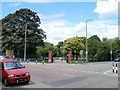
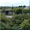
CF5 1BQ, a small residential postcode area in Cardiff, Wales, covers just 5,533 square metres and is home to 1,278 residents. This densely populated cluster lies in the suburban district of Canton, historically a market town dating back to the 13th century. Today, it blends urban convenience with suburban charm, offering a mix of traditional and modern amenities. The area’s compact size fosters a tight-knit community, with residents benefiting from proximity to the River Taff, local parks, and a range of shops and services. Canton’s history as a hub for trade and industry during the Industrial Revolution still influences its character, with a strong sense of local identity. The area’s bilingual Welsh-English population, combined with its family-friendly environment, makes it appealing to those seeking a balance between city access and quieter living. With direct rail links to Cardiff city centre and nearby transport routes, CF5 1BQ is well-connected yet retains a distinct, community-focused atmosphere. Its blend of heritage and modernity, along with accessible amenities, defines daily life here.
- Area Type
- Postcode
- Area Size
- 5533 m²
- Population
- 1278
- Population Density
- 5642 people/km²
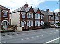
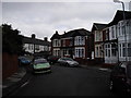
The property market in CF5 1BQ is characterised by a high rate of home ownership (82%) and a focus on single-family homes. This suggests a community where long-term residency and investment in property are common. The predominance of houses over flats or apartments reflects a preference for larger living spaces, which may appeal to families or professionals seeking space. Given the area’s small size, the housing stock is likely limited, making it a competitive market for buyers. Proximity to Cardiff’s city centre, combined with local amenities like schools and parks, enhances the area’s desirability. However, buyers should consider the compact nature of the postcode, which may mean limited options for expansion or development. The high home ownership rate also implies a stable market, with properties likely retaining value due to demand from both residents and commuters.
House Prices in CF5 1BQ
Showing 26 properties
| Address | Type | Beds | Baths | Last Sale Price | Last Sale Date | |
|---|---|---|---|---|---|---|
| 26 Redcliffe Avenue, Canton, Cardiff, CF5 1BQ | Terraced | 3 | 1 | £310,000 | May 2024 | |
| 5 Redcliffe Avenue, Canton, Cardiff, CF5 1BQ | house | - | - | £330,000 | Dec 2021 | |
| 9 Redcliffe Avenue, Canton, Cardiff, CF5 1BQ | house | - | - | £350,000 | Nov 2020 | |
| 3 Redcliffe Avenue, Canton, Cardiff, CF5 1BQ | house | - | - | £320,000 | Mar 2020 | |
| 24 Redcliffe Avenue, Canton, Cardiff, CF5 1BQ | Terraced | 3 | - | £308,000 | Aug 2019 | |
| 2 Redcliffe Avenue, Canton, Cardiff, CF5 1BQ | Terraced | 3 | 1 | £230,000 | Nov 2018 | |
| 22 Redcliffe Avenue, Canton, Cardiff, CF5 1BQ | Terraced | 3 | 2 | £320,000 | Jul 2018 | |
| 6 Redcliffe Avenue, Canton, Cardiff, CF5 1BQ | Terraced | - | - | £220,000 | Mar 2013 | |
| 12 Redcliffe Avenue, Canton, Cardiff, CF5 1BQ | house | - | - | £170,000 | Feb 2009 | |
| 7 Redcliffe Avenue, Canton, Cardiff, CF5 1BQ | house | 3 | - | £180,000 | Sep 2006 |
Energy Efficiency in CF5 1BQ
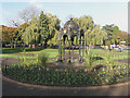
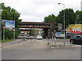
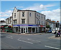
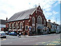
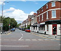
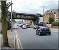
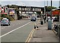
Living in CF5 1BQ offers a blend of convenience and community. Retail options include Spar, Co-op Cardiff, and Tesco Cardiff, providing everyday essentials. The area’s proximity to the River Taff offers scenic walking and cycling paths, while local landmarks like Canton Cross and the Corp Market add to its character. Community hubs such as the Canton Community Hall and Canton Uniting Church host events, fostering social connections. Schools like Cantonian High School and Ysgol Treganna cater to families, and the area’s bilingual Welsh-English demographic reflects its cultural diversity. Transport links to Cardiff’s city centre, combined with nearby rail and ferry services, ensure easy access to shopping, dining, and cultural attractions. The mix of traditional and modern amenities, from historic markets to contemporary retail, creates a lifestyle that balances heritage with contemporary needs.
Amenities
Schools
| Rank | School | Type | Entry gender | Ages |
|---|
Explore more schools in this area
Go to Schools tabDemographics
The population of CF5 1BQ has a median age of 47, with the majority of residents aged between 30 and 64. This suggests a stable, middle-aged demographic, often associated with established families or long-term residents. Home ownership is high, at 82%, indicating a community rooted in property investment and long-term residency. The accommodation type is predominantly houses, reflecting a preference for single-family homes over flats or apartments. The predominant ethnic group is White, aligning with broader trends in the region. While specific data on deprivation is not provided, the high home ownership rate and age profile suggest a relatively stable socioeconomic environment. The area’s proximity to schools, retail, and transport links further supports a quality of life that appeals to families and professionals. The absence of significant rental housing indicates a market skewed towards owner-occupation, which can influence property values and community dynamics.
Household Size
Accommodation Type
Tenure
Ethnic Group
Religion
Household Composition
Age
Household Deprivation
NS-SEC
Explore more demographic insights in this area
Go to Demographics tabPlanning
Planning Constraints
- Flood RiskPremium
- Ramsar Wetland SitesPremium
- Area of Outstanding Natural BeautyPremium
- Protected Nature ReservePremium
- Protected WoodlandPremium
- Crime RiskPremium