Area Overview for CF4 4UE
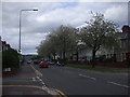
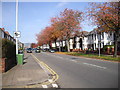
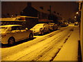
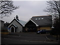
Photos of CF4 4UE

Area Information
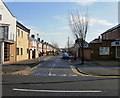
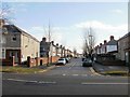
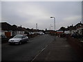
CF4 4UE represents a specific residential cluster within the broader Heath district of Cardiff, situated in the north of the city. You can expect to live in an area defined by settlement rather than vast open spaces, fitting a community of 2,570 people. This postcode area is embedded within a district that has evolved from ancient common land known as the Great Heath into a modern residential neighbourhood. The location centres around coordinates 51.511853, -3.194695, placing it amidst the unique development history of Heath. Living in CF4 4UE offers the benefits of established suburban housing without the isolation of remote rural living. The area benefits from proximity to significant local landmarks such as University Hospital Wales, often referred to simply as The Heath. This hospital opened in 1971 following the clearance of 53 acres of Heath Wood, marking a significant shift in the landscape. Residents also enjoy access to Heath Park, which stands as a former racecourse purchased by Cardiff Council in 1938. The park was designated King George's Field in 1952 and renewed in 2010, providing a green space for local recreation. Your daily life here connects you to a mix of suburban tranquility and urban convenience. The area sits near the historic battlefields where the Battle of the Heath took place in 1646, adding a layer of historical depth to your surroundings. As part of the city's growth, urban development began in 1848 by Wyndham Lewis, transforming farms like Heath Farm and Ton-yr-Ywen into the residential zones you see today. The small scale of CF4 4UE ensures that neighbours often know one another, creating a tight-knit environment. You will find yourself in a place where the past informs the present, with ancient enclosures evolving into the homes and institutions that serve the community now.
- Area Type
- Postcode
- Area Size
- Not available
- Population
- 2570
- Population Density
- 7762 people/km²
You are entering a property market defined by stability and ownership rather than short-term rental speculation. With 69% of residents being homeowners, CF4 4UE presents itself as an area where people have put down roots. This high rate of home ownership usually translates to better-maintained properties and a neighbourhood where residents have a vested interest in their surroundings. The stock in this postcode consists primarily of houses, offering space and ground-level privacy that appeals to families. This dominance of houses means you will rarely encounter conversion flats or dwindling tenement buildings common in city centres. The housing stock reflects the urban development that began in 1848 by Wyndham Lewis, resulting in a mix of mid-20th century and established suburban properties. These homes were built to accommodate the expansion from farms like Heath Farm and Allensbank Farm into residential zones. For buyers looking at homes in CF4 4UE, the market dynamics differ from newly built developments in other parts of South East Wales. The emphasis is on quality older housing rather than new-build speculative housing. You might find that properties retain their original character, offering practical layouts suited to average-sized families. The area sits within the CF14 3XW postcode classification for the Heath district, meaning your specific property could share walls with neighbours living in a historically connected community. Purchasing here requires viewing existing stock rather than chasing unfixed-plot new builds. The market is driven by locals buying homes that have stood the test of time, ensuring structural integrity and familiar neighbourhood standards. This makes CF4 4UE an attractive option for those seeking established housing stock within the city limits, avoiding the unpredictability of new developments.
House Prices in CF4 4UE
No properties found in this postcode.
Energy Efficiency in CF4 4UE
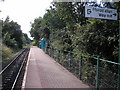
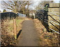
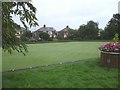
Your daily life in CF4 4UE centres around convenient access to major retailers and leisure facilities. Just a short drive or bus ride away, you will find Lidl Birchgrove, Aldi Caerphilly, and Tesco Cardiff Maes Y. These three major supermarkets ensure that essential groceries and household needs are always within easy reach. You do not need to travel far to stock your fridge or purchase home necessities, reducing car dependency for routine errands. Rail travel plays a significant role in your lifestyle, with five stations listed as key amenities. The presence of Ty Glas, Birchgrove, and Rhiwbina Railway Stations means you can catch a train directly from your doorstep. This connectivity links you to the broader transport network, facilitating visits to city attractions and business appointments. For those who prefer water travel, five ferry stops offer alternatives. You can board the Waterbus at Cardiff Castle, Taffs Mead, or Clarence Embankment, adding variety to your travel routine. Green spaces define the character of your weekends, anchored by Heath Park. This 330-acre park, formerly a racecourse, offers extensive walking trails, sports facilities, and open fields. The park's history dates back to its enclosure and purchase by the council in 1938, creating a well-maintained area for family outings. You can enjoy picnics by the lake, use the tennis courts, or take the scenic Anderson Road Bridge path. For larger excursions, the area serves as a gateway to iconic Cardiff attractions. Cardiff Castle stands nearby, offering historic tours and cultural events. You can also explore the Cardiff International Bus services which link you to the city centre and beyond. This blend of local supermarkets, extensive parkland, and multimodal transport options creates a balanced lifestyle where convenience and nature coexist seamlessly in CF4 4UE.
Amenities
Schools
| Rank | School | Type | Entry gender | Ages |
|---|
Explore more schools in this area
Go to Schools tabDemographics
The community in CF4 4UE reflects a mature population profile typical of established Cardiff suburbs. The median age here is 47, indicating that families and professionals in their middle years form the backbone of the neighbourhood. Most residents fall into the adult age range between 30 and 64 years, suggesting stability over frequent turnover. This demographic shift often brings increased demand for schools near CF4 4UE and amenities catering to older children and teenagers. Home ownership stands at 69%, which signifies a highly settled population with strong local ties. This high rate suggests that current or retired families have invested deeply in this specific postcode area. The remaining 31% of households likely comprise renters or those in the process of buying. This balance creates a stable market where long-term residents often influence local development decisions and community standards. Houses dominate the accommodation type for this postcode, distinguishing it from the flat-heavy zones found in central Cardiff. White forms the predominant ethnic group, aligning with the wider demographic composition of the broader Heath district. You will find that the streets of CF4 4UE are characterised by family homes suited to this age demographic, rather than the student housing prevalent near major university campuses. The area's character is shaped by these household types, fostering an environment where community engagement and local governance tend to be active.
Household Size
Accommodation Type
Tenure
Ethnic Group
Religion
Household Composition
Age
Household Deprivation
NS-SEC
Explore more demographic insights in this area
Go to Demographics tabPlanning
Planning Constraints
- Flood RiskPremium
- Ramsar Wetland SitesPremium
- Area of Outstanding Natural BeautyPremium
- Protected Nature ReservePremium
- Protected WoodlandPremium
- Crime RiskPremium