Area Overview for CF4 2XJ
Photos of CF4 2XJ

Area Information
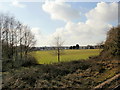
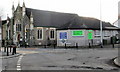
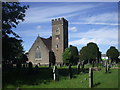
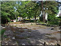
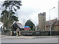
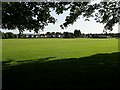
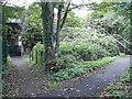
CF4 2XJ is a small residential postcode area in north-west Cardiff, Wales, encompassing a cluster of homes with a population of 1,446. Situated near the River Taff, the area has historical roots tied to medieval mills and St. Mary’s chapel, which gave Whitchurch its name. Today, it is a quiet, low-density neighbourhood where houses dominate the housing stock. The area’s compact size means residents are close to key amenities, including retail outlets, rail stations, and waterbus stops. With a median age of 47 and a population skewed toward adults aged 30–64, the community is largely established, with 86% of homes owned by residents. Daily life here balances proximity to Cardiff’s urban centre with a sense of local identity, reflected in landmarks like the 19th-century Whitchurch Methodist Church and historic sites such as Castell Coch. The area’s small scale fosters a close-knit feel, though its limited size means housing options are constrained. For those seeking a settled, family-oriented environment with easy access to transport and retail, CF4 2XJ offers a blend of historical charm and practical convenience.
- Area Type
- Postcode
- Area Size
- Not available
- Population
- 1446
- Population Density
- 4629 people/km²
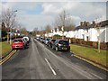
CF4 2XJ is primarily an owner-occupied area, with 86% of homes owned by residents rather than rented. The housing stock is dominated by houses, reflecting a preference for larger, more private properties over flats or apartments. This composition suggests a community focused on family living, with homes likely offering more space and garden areas. The small postcode area means housing options are limited, which could make the market competitive for buyers. Given the high home ownership rate, rental availability is likely constrained, potentially limiting choices for those seeking to rent. The predominance of houses also implies that the area may appeal to buyers prioritising privacy and space over urban density. However, the limited size of CF4 2XJ means that property values and availability are closely tied to the broader Whitchurch and Tongwynlais regions, where additional housing stock may be found.
House Prices in CF4 2XJ
No properties found in this postcode.
Energy Efficiency in CF4 2XJ
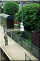
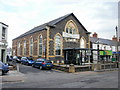
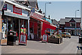
Residents of CF4 2XJ have access to a range of amenities within practical reach. Retail options include major stores such as Tesco Whitchurch, Iceland Cardiff, and Co-op Whitchurch, providing everyday shopping convenience. The area’s rail network connects to Llandaf, Whitchurch, and Coryton stations, facilitating travel to Cardiff’s business and cultural hubs. Waterbus stops at Cardiff Castle, Taffs Mead, and Channel View offer scenic and efficient transport along the River Taff. While the area has limited dining options, the proximity to Cardiff’s wider retail and leisure districts means residents can access a broader selection of restaurants, cafes, and entertainment venues. The presence of multiple transport options and retail outlets enhances the area’s livability, supporting both daily errands and weekend excursions. The combination of practical amenities and transport links ensures a balanced lifestyle, blending local convenience with urban accessibility.
Amenities
Schools
The nearest school to CF4 2XJ is Whitchurch High School, though its type and Ofsted rating are not specified in the data. The absence of additional schools in the area suggests that families may need to look beyond CF4 2XJ for primary or secondary education options. The single listed school indicates a reliance on broader Cardiff infrastructure for educational needs. For families prioritising local schooling, this could mean longer commutes or reliance on nearby districts. However, the presence of a school within the area provides a basic level of convenience, reducing the need for extensive travel. The lack of detailed performance data means prospective buyers should investigate further to assess the school’s suitability for their children’s needs.
| Rank | School | Type | Entry gender | Ages |
|---|
Explore more schools in this area
Go to Schools tabDemographics
The population of CF4 2XJ is 1,446, with a median age of 47. The majority of residents are adults aged 30–64, reflecting a mature, stable community. Home ownership is high at 86%, indicating a strong presence of long-term residents. The area is predominantly composed of houses, suggesting a focus on family-oriented living rather than apartments or flats. The predominant ethnic group is White, though specific diversity statistics are not detailed. The age profile suggests a community with established careers and families, likely with a lower proportion of young professionals or students. This demographic mix may influence local services, with amenities tailored to older adults and families. The absence of significant deprivation data means the area’s quality of life is likely supported by its infrastructure and proximity to services. However, the high median age also implies a need for age-friendly amenities, such as accessible public transport and healthcare facilities.
Household Size
Accommodation Type
Tenure
Ethnic Group
Religion
Household Composition
Age
Household Deprivation
NS-SEC
Explore more demographic insights in this area
Go to Demographics tabPlanning
Planning Constraints
- Flood RiskPremium
- Ramsar Wetland SitesPremium
- Area of Outstanding Natural BeautyPremium
- Protected Nature ReservePremium
- Protected WoodlandPremium
- Crime RiskPremium