Area Overview for CF3 9YP
Photos of CF3 9YP


Area Information
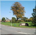
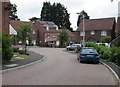
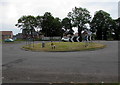
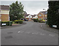
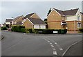
CF3 9YP is a small, historic postcode area in Wales, encompassing a residential cluster on the eastern edge of Cardiff. With a population of 1,473, it retains a village character shaped by 19th-century housing, fields, and historic structures. The area is part of Old St Mellons, a civil parish separated from modern St Mellons by Newport Road. Its roots stretch back to prehistoric times, with evidence of Silures activity and a medieval church dating to the 13th century. Today, the area balances its rural heritage with modern living, featuring a mix of cottages, community spaces, and open fields. Residents benefit from proximity to Cardiff’s east suburbs, offering regional connectivity without the density of the city centre. The area’s Conservation Area status, designated in 1976, ensures its historical buildings and traditional layout remain intact. Daily life here is defined by a quiet, preserved village atmosphere, with local amenities and transport links providing practical access to nearby services. For buyers seeking a low-maintenance, historically rich environment, CF3 9YP offers a unique blend of heritage and accessibility.
- Area Type
- Postcode
- Area Size
- Not available
- Population
- 1473
- Population Density
- 5913 people/km²
The property market in CF3 9YP is characterised by a 45% home ownership rate, with houses being the predominant accommodation type. This suggests a mix of owner-occupied properties and rental units, though the exact balance between the two is not specified. The presence of 19th-century housing, as noted in historical research, indicates a stock of older, potentially characterful homes that may appeal to buyers seeking period properties. However, the relatively low home ownership rate could imply a higher proportion of rental properties, possibly attracting younger or transient residents. Given the area’s Conservation Area status, property development is likely restricted, preserving the traditional layout. For buyers, this means a focus on existing homes rather than new builds, with potential for renovation or restoration. The small size of the area means the immediate surroundings may offer limited housing options, requiring buyers to consider nearby suburbs for broader choices.
House Prices in CF3 9YP
No properties found in this postcode.
Energy Efficiency in CF3 9YP
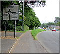
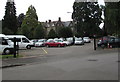
Residents of CF3 9YP have access to a range of nearby amenities, including retail outlets like Tesco Cardiff and Morrisons Daily St, as well as local pubs and shops. The area’s proximity to Heath High Level and Llanishen Railway Stations provides convenient access to Cardiff’s transport network. Ferry services, such as the Taffs Mead Waterbus Stop, offer scenic travel options along the River Taff. The nearby Cardiff Bus Interchange connects to broader regional routes. The village’s historic character is complemented by open spaces and fields, offering opportunities for outdoor activities. While the area lacks large leisure facilities, its small-scale amenities and preserved environment create a relaxed lifestyle. The mix of retail, transport, and green spaces supports a practical, community-focused daily life, with easy access to both local and city-based services.
Amenities
Schools
The nearest school to CF3 9YP is Oakfield Primary School, though its type and Ofsted rating are not specified in the data. The absence of detailed school performance metrics means prospective families must rely on local reputation or additional research to assess educational quality. The area’s demographic profile, with a median age of 47 and a focus on adult residents, may suggest fewer young families compared to other suburbs. However, the presence of a primary school indicates some local provision for children. For families requiring secondary education, proximity to Cardiff’s broader network of schools would be essential. The lack of specific data on school types or ratings means buyers should investigate further to align educational needs with the area’s offerings.
| Rank | School | Type | Entry gender | Ages |
|---|---|---|---|---|
| 1 | Oakfield Primary School | other | N/A | N/A |
Explore more schools in this area
Go to Schools tabDemographics
The population of CF3 9YP has a median age of 47, with the majority of residents aged 30–64 years. Home ownership stands at 45%, indicating a mix of owner-occupied and rental properties. The area is predominantly White, reflecting its long-standing demographic patterns. The accommodation type is primarily houses, suggesting a more spread-out, suburban layout compared to high-density housing. This profile aligns with the area’s village character, where 19th-century cottages and larger homes dominate. The age distribution suggests a stable community with fewer young families, which may influence local services and amenities. The lack of specific deprivation data means quality of life is inferred from the area’s preserved infrastructure and low environmental risks. Residents likely value the area’s historical significance and quieter lifestyle, though the 45% home ownership rate implies a portion of the population may be renters, possibly younger or transient.
Household Size
Accommodation Type
Tenure
Ethnic Group
Religion
Household Composition
Age
Household Deprivation
NS-SEC
Explore more demographic insights in this area
Go to Demographics tabPlanning
Planning Constraints
- Flood RiskPremium
- Ramsar Wetland SitesPremium
- Area of Outstanding Natural BeautyPremium
- Protected Nature ReservePremium
- Protected WoodlandPremium
- Crime RiskPremium