Area Overview for CF3 5JU
Photos of CF3 5JU

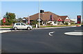
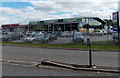
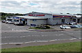
28 photos from this area
Area Information
Key information about the CF3 5JU including its size, population, and administrative classification.
- Area Type
- Postcode
- Area Size
- 7132 m²
- Population
- 1584
- Population Density
- 4781 people/km²
House Prices in CF3 5JU
18
Properties
£83,817
Average Sold Price
£21,500
Lowest Price
£180,000
Highest Price
Showing 18 properties
| Address | Type | Beds | Baths | Last Sale Price | Last Sale Date | |
|---|---|---|---|---|---|---|
| 29 Thackeray Crescent, Llanrumney, Cardiff, CF3 5JU | Terraced | 3 | 1 | £180,000 | May 2024 | |
| 27 Thackeray Crescent, Llanrumney, Cardiff, CF3 5JU | house | - | - | £21,500 | Jul 2004 | |
| 25 Thackeray Crescent, Llanrumney, Cardiff, CF3 5JU | Terraced | - | - | £49,950 | Dec 2001 | |
| 31 Thackeray Crescent, Llanrumney, Cardiff, CF3 5JU | house | - | - | - | - | |
| 19 Thackeray Crescent, Llanrumney, Cardiff, CF3 5JU | Bungalow | - | - | - | - | |
| 5 Thackeray Crescent, Llanrumney, Cardiff, CF3 5JU | Bungalow | - | - | - | - | |
| 9 Thackeray Crescent, Llanrumney, Cardiff, CF3 5JU | Bungalow | - | - | - | - | |
| 15 Thackeray Crescent, Llanrumney, Cardiff, CF3 5JU | Bungalow | - | - | - | - | |
| 23 Thackeray Crescent, Llanrumney, Cardiff, CF3 5JU | house | - | - | - | - | |
| 3 Thackeray Crescent, Llanrumney, Cardiff, CF3 5JU | Bungalow | - | - | - | - |
Page 1 of 2
Energy Efficiency in CF3 5JU
Amenities
Schools
| Rank | School | Type | Entry gender | Ages |
|---|
Explore more schools in this area
Go to Schools tabDemographics
Household Size
Family (3-5 people)
most common
Accommodation Type
Houses
most common
Tenure
55
majority
Ethnic Group
White
most common
Religion
N/A
most common
Household Composition
N/A
most common
Age
47
median
Adults (30-64 years)
most common
Household Deprivation
N/A
with no deprivation
NS-SEC
16
in Lower managerial occupations
Explore more demographic insights in this area
Go to Demographics tabPlanning
Planning Constraints
- Flood RiskPremium
- Ramsar Wetland SitesPremium
- Area of Outstanding Natural BeautyPremium
- Protected Nature ReservePremium
- Protected WoodlandPremium
- Crime RiskPremium