Area Overview for CF24 5HN
Photos of CF24 5HN


Area Information
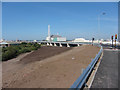
CF24 5HN lies in the heart of Splott, a historic district in Cardiff’s south, blending Victorian terraced housing with a legacy of industrial heritage. The area covers just 1.1 hectares, yet it is densely populated, with 1,541 residents packed at 1,382 people per square kilometre. This compact postcode cluster reflects Splott’s evolution from 19th-century farmland into a tightly knit working-class suburb. Today, it retains its character through broad streets, stone terraces, and community landmarks like the Magic Roundabout market. The area’s proximity to Cardiff’s city centre and transport hubs makes it a practical choice for commuters, while its low flood risk and absence of environmental constraints offer reassurance. Splott’s identity is shaped by its past as a steelworkers’ district, with remnants like the disused aerodrome and Splott Park—opened in 1901—adding to its charm. Living here means embracing a compact, historically rich environment where daily life revolves around local shops, rail links, and the enduring presence of community spaces.
- Area Type
- Postcode
- Area Size
- 1.1 hectares
- Population
- 1541
- Population Density
- 1382 people/km²
CF24 5HN’s property market is defined by its 21% home ownership rate, indicating that the majority of properties are rented rather than owner-occupied. The accommodation type is predominantly houses, reflecting Splott’s Victorian terraced housing stock. This contrasts with areas dominated by flats or modern developments. The small area size—just 1.1 hectares—means the housing stock is limited, with little scope for new builds or expansion. For buyers, this suggests a niche market with limited inventory, potentially driving competition for available homes. The presence of houses rather than flats may appeal to those seeking traditional, spacious properties. However, the low home ownership rate implies that rental demand could be strong, particularly from families or professionals seeking stable, long-term housing. Buyers should consider the area’s compact nature and its proximity to transport links when evaluating its appeal.
House Prices in CF24 5HN
No properties found in this postcode.
Energy Efficiency in CF24 5HN
Residents of CF24 5HN have access to a range of amenities within practical reach. The nearby retail options include Co-op Splott, Lidl Splott, and Tesco Clifton, offering everyday shopping needs. The area’s rail links to Cardiff Bay, Queen Street, and Central stations provide easy access to the city’s commercial and cultural hubs. For leisure, Splott Park—opened in 1901—offers green space for recreation, while the Magic Roundabout market adds a local touch to daily life. The disused public park being redeveloped into a community space hints at future improvements. The presence of ferry stops at Mermaid Quay and Sovereign Quay enhances connectivity to waterfront areas. Though the number of amenities is modest, their proximity to transport links ensures residents can quickly access broader Cardiff amenities, balancing convenience with the area’s compact, historic character.
Amenities
Schools
The nearest school to CF24 5HN is ACT Schools, categorised as an ‘other’ type in the data. No Ofsted rating is provided, so its academic performance or facilities cannot be assessed here. The absence of other schools in the immediate vicinity suggests limited educational options for families relying solely on local institutions. This may require parents to consider commuting to nearby areas for secondary education or additional schooling. The single school listed does not indicate a diverse range of educational providers, such as state or independent schools, which could be a consideration for families prioritising school choice. However, the area’s proximity to Cardiff’s city centre may provide access to broader educational networks beyond the immediate postcode.
| Rank | School | Type | Entry gender | Ages |
|---|
Explore more schools in this area
Go to Schools tabDemographics
The population of CF24 5HN is predominantly adults aged 30–64, with a median age of 47, reflecting a mature, stable community. Home ownership here is relatively low at 21%, suggesting a mix of renters and owner-occupiers. The area is characterised by houses rather than flats, aligning with its historical development as a working-class suburb. The predominant ethnic group is White, with no specific data on other demographics. The high population density—1,382 people per square kilometre—indicates a compact, closely lived-in environment. This density may influence local services and amenities, but it also fosters a sense of community. The absence of detailed deprivation data means quality of life factors like access to healthcare or leisure facilities are not quantified here. However, the area’s proximity to retail, transport, and green spaces suggests a balance between urban convenience and residential comfort.
Household Size
Accommodation Type
Tenure
Ethnic Group
Religion
Household Composition
Age
Household Deprivation
NS-SEC
Explore more demographic insights in this area
Go to Demographics tabPlanning
Planning Constraints
- Flood RiskPremium
- Ramsar Wetland SitesPremium
- Area of Outstanding Natural BeautyPremium
- Protected Nature ReservePremium
- Protected WoodlandPremium
- Crime RiskPremium