Area Overview for CF24 4TW
Photos of CF24 4TW
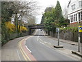
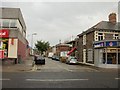
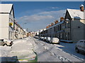
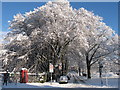


94 photos from this area
Area Information
Key information about the CF24 4TW including its size, population, and administrative classification.
- Area Type
- Postcode
- Area Size
- 3762 m²
- Population
- 1588
- Population Density
- 15880 people/km²
House Prices in CF24 4TW
34
Properties
£219,447
Average Sold Price
£66,950
Lowest Price
£330,000
Highest Price
Showing 34 properties
| Address | Type | Beds | Baths | Last Sale Price | Last Sale Date | |
|---|---|---|---|---|---|---|
| 42 Diana Street, Roath, Cardiff, CF24 4TW | Terraced | 2 | 1 | £277,500 | Jun 2025 | |
| 58 Diana Street, Roath, Cardiff, CF24 4TW | house | 3 | 1 | £307,750 | Jan 2025 | |
| 62 Diana Street, Roath, Cardiff, CF24 4TW | Terraced | 3 | 1 | £289,750 | Oct 2024 | |
| 50 Diana Street, Roath, Cardiff, CF24 4TW | Terraced | 1 | 2 | £321,000 | Apr 2023 | |
| 72 Diana Street, Roath, Cardiff, CF24 4TW | Terraced | 3 | 1 | £300,000 | May 2022 | |
| 46 Diana Street, Roath, Cardiff, CF24 4TW | house | 5 | 1 | £246,100 | Dec 2021 | |
| 70 Diana Street, Roath, Cardiff, CF24 4TW | house | 3 | 1 | £261,500 | Oct 2021 | |
| 80 Diana Street, Roath, Cardiff, CF24 4TW | Terraced | 3 | 2 | £295,000 | Oct 2021 | |
| 84 Diana Street, Roath, Cardiff, CF24 4TW | house | - | - | £330,000 | Jun 2021 | |
| 44 Diana Street, Roath, Cardiff, CF24 4TW | Terraced | 5 | 1 | £235,000 | Dec 2019 |
Page 1 of 4
Energy Efficiency in CF24 4TW
Amenities
Schools
| Rank | School | Type | Entry gender | Ages |
|---|
Explore more schools in this area
Go to Schools tabDemographics
Household Size
Family (3-5 people)
most common
Accommodation Type
Houses
most common
Tenure
47
majority
Ethnic Group
White
most common
Religion
N/A
most common
Household Composition
N/A
most common
Age
22
median
Young Adults (15-29 years)
most common
Household Deprivation
N/A
with no deprivation
NS-SEC
30
in Lower managerial occupations
Explore more demographic insights in this area
Go to Demographics tabPlanning
Planning Constraints
- Flood RiskPremium
- Ramsar Wetland SitesPremium
- Area of Outstanding Natural BeautyPremium
- Protected Nature ReservePremium
- Protected WoodlandPremium
- Crime RiskPremium