Area Overview for CF24 1DJ
Photos of CF24 1DJ
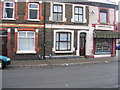
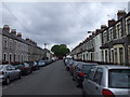
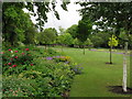
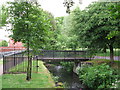


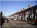


99 photos from this area
Area Information
Key information about the CF24 1DJ including its size, population, and administrative classification.
- Area Type
- Postcode
- Area Size
- 9018 m²
- Population
- 2098
- Population Density
- 11649 people/km²
House Prices in CF24 1DJ
45
Properties
£128,000
Average Sold Price
£50,000
Lowest Price
£250,000
Highest Price
Showing 45 properties
| Address | Type | Beds | Baths | Last Sale Price | Last Sale Date | |
|---|---|---|---|---|---|---|
| 144-146 Newport Road, Roath, Cardiff, CF24 1DJ | Terraced | - | - | £250,000 | Oct 2010 | |
| 154 Newport Road, Roath, Cardiff, CF24 1DJ | Flat | 12 | 12 | £50,000 | Mar 2007 | |
| 134 Newport Road, Mayfair Hotel, Cardiff, CF24 1DJ | hotel | 14 | 1 | £84,000 | Aug 1997 | |
| Cardiff Hotel, 138 Newport Road, Roath, Cardiff, CF24 1DJ | Detached | 14 | 12 | - | - | |
| Apartment 1, Central Court, 132 Newport Road, Roath, Cardiff, CF24 1DJ | Flat | 2 | 2 | - | - | |
| Ground And First Floor Flat, 140 Newport Road, Roath, Cardiff, CF24 1DJ | Flat | - | - | - | - | |
| Second Floor Flat, 140 Newport Road, Roath, Cardiff, CF24 1DJ | Flat | - | - | - | - | |
| Apartment 2, Central Court, 132 Newport Road, Roath, Cardiff, CF24 1DJ | Flat | - | - | - | - | |
| Apartment 13, Central Court, 132 Newport Road, Roath, Cardiff, CF24 1DJ | Flat | - | - | - | - | |
| Apartment 7, Central Court, 132 Newport Road, Roath, Cardiff, CF24 1DJ | Flat | - | - | - | - |
Page 1 of 5
Energy Efficiency in CF24 1DJ
Amenities
Schools
| Rank | School | Type | Entry gender | Ages |
|---|
Explore more schools in this area
Go to Schools tabDemographics
Household Size
One person
most common
Accommodation Type
Flats
most common
Tenure
27
majority
Ethnic Group
White
most common
Religion
N/A
most common
Household Composition
N/A
most common
Age
47
median
Adults (30-64 years)
most common
Household Deprivation
N/A
with no deprivation
NS-SEC
25
in Lower managerial occupations
Explore more demographic insights in this area
Go to Demographics tabPlanning
Planning Constraints
- Flood RiskPremium
- Ramsar Wetland SitesPremium
- Area of Outstanding Natural BeautyPremium
- Protected Nature ReservePremium
- Protected WoodlandPremium
- Crime RiskPremium