Area Overview for CF24 0RZ
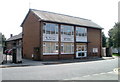
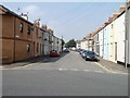
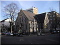
Photos of CF24 0RZ

Area Information
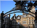
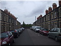
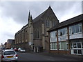
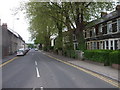
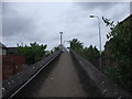
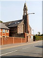
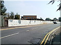
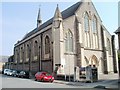
CF24 0RZ, known as Adamsdown, is a compact inner-city suburb in Cardiff, Wales, with a population of 3,991 spread over just 1.1 hectares. Its density reflects a long history as a working-class community, shaped by 19th-century developments like the 1848 cemetery-turned-park and the former Cardiff Royal Infirmary. Today, it straddles the boundary between Roath and Cardiff’s medieval walls, blending historical charm with modern regeneration. The area has seen improvements since 2008, including better parking, security, and a multi-use games area in Cemetery Park. Living here means navigating a tight-knit, urban environment with a focus on practicality. The proximity to Cardiff’s core offers easy access to the city’s cultural and economic hubs, while the area’s compact size means amenities are within walking distance. Its character is defined by a mix of old and new—residual traces of 19th-century infrastructure sit alongside contemporary housing stock, creating a dynamic, evolving neighbourhood.
- Area Type
- Postcode
- Area Size
- 1.1 hectares
- Population
- 3991
- Population Density
- 11495 people/km²
The property market in CF24 0RZ is characterised by a low home ownership rate of 14%, indicating that the majority of residents are renters. Flats dominate the housing stock, reflecting the area’s compact size and historical development as a working-class suburb. With only 1.1 hectares of land, the housing stock is limited, and the small footprint suggests that the area is primarily a rental market rather than a buyers’ market. This dynamic may appeal to those seeking affordable, short-term housing or investment opportunities in a city-centre location. However, the limited space and high density mean competition for properties is likely. Buyers should consider the area’s proximity to Cardiff’s amenities, which could offset the lack of private ownership. The focus on flats also means that potential buyers may find fewer options for larger homes or family properties.
House Prices in CF24 0RZ
Showing 1 properties
| Address | Type | Beds | Baths | Last Sale Price | Last Sale Date | |
|---|---|---|---|---|---|---|
| Cardiff Magistrates Court, Probation Services Offices, Fitzalan Place, Adamsdown, Cardiff, CF24 0RZ | commercial | - | - | - | - |
Energy Efficiency in CF24 0RZ
CF24 0RZ offers a range of amenities within practical reach, enhancing daily life for residents. Five retail outlets, including Tesco Howard, Morrisons Daily, and Spar, provide essential shopping options. The area’s transport links—rail, bus, and ferry—connect it to Cardiff’s broader network, enabling easy access to cultural, commercial, and recreational spaces. Nearby parks, such as Cemetery Park, offer leisure opportunities with a multi-use games area. The historical character of Adamsdown, with its 19th-century infrastructure and recent regeneration, adds to the area’s appeal. While the data does not specify dining options, the proximity to Cardiff’s city centre suggests a variety of restaurants and cafes are accessible. The combination of practical amenities and urban connectivity makes CF24 0RZ a convenient base for those prioritising accessibility and convenience.
Amenities
Schools
The nearest school to CF24 0RZ is Tredegarville C.I.W. Primary School, listed as an ‘other’ type in the data. No specific Ofsted rating is provided, so its performance remains unspecified. The school’s presence suggests that families with young children have access to local education, though the lack of detailed information on its quality or capacity may require further investigation. The absence of secondary schools or additional educational institutions in the data means that parents may need to look beyond CF24 0RZ for comprehensive schooling options. The mix of school types—only primary in this case—highlights the need for families to consider broader transport networks to access secondary education or other educational facilities in Cardiff.
| Rank | School | Type | Entry gender | Ages |
|---|
Explore more schools in this area
Go to Schools tabDemographics
CF24 0RZ has a median age of 22, with the majority of residents aged 15–29. This young demographic shapes the area’s social fabric, reflecting a focus on affordability and proximity to employment. Home ownership is low at 14%, indicating a rental-dominated market, with flats being the primary accommodation type. The predominant ethnic group is White, though specific diversity metrics are not provided. The high population density—367,214 people per square kilometre—suggests a compact, densely populated environment. This density can influence daily life, with shared spaces and communal living being common. The area’s youthful profile may appeal to students or young professionals, though the lack of homeownership suggests a transient population. The mix of age groups and housing types creates a community that is both active and evolving, with needs shaped by its urban context.
Household Size
Accommodation Type
Tenure
Ethnic Group
Religion
Household Composition
Age
Household Deprivation
NS-SEC
Explore more demographic insights in this area
Go to Demographics tabPlanning
Planning Constraints
- Flood RiskPremium
- Ramsar Wetland SitesPremium
- Area of Outstanding Natural BeautyPremium
- Protected Nature ReservePremium
- Protected WoodlandPremium
- Crime RiskPremium