Area Overview for CF23 9WA
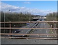
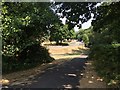
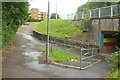
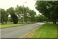
Photos of CF23 9WA


Area Information
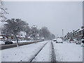
CF23 9WA lies in the Llanedeyrn district of eastern Cardiff, a small residential cluster with a population of 1441. Situated 3.5 miles from the city centre, it straddles the River Rhymney boundary with Monmouthshire, divided by the M4-A48 link road. Historically a rural parish named after St Edeyrn, a 6th-century saint, the area evolved into a suburban district post-1889, with housing estates developed from the 1960s onwards. Today, it features 1960s-1970s council housing, including terraced homes and flats, creating a compact, working-class community. The area blends practical living with proximity to affluent Cyncoed and access to the M4 motorway, supporting local commerce and transport links. While social housing dominates, the area retains a sense of neighbourly resilience, though challenges in community integration persist for some families. Its modest scale and historical roots make it distinct within Cardiff’s urban sprawl.
- Area Type
- Postcode
- Area Size
- Not available
- Population
- 1441
- Population Density
- 5428 people/km²
The property market in CF23 9WA is characterised by a 63% home ownership rate, with houses being the predominant accommodation type. This suggests a mix of owner-occupied homes and rental properties, though the data does not specify the latter’s scale. The housing stock primarily consists of 1960s-1970s council-built terraced houses and flats, reflecting a planned suburban development. These properties are likely to be more affordable than newer builds, making the area appealing to first-time buyers or those seeking value. However, the small size of the postcode area means the immediate surroundings may offer limited property diversity. For buyers, the focus on owner-occupation indicates a community of long-term residents, potentially offering a stable investment opportunity. The presence of social housing also suggests a balance between private and public sector properties.
House Prices in CF23 9WA
No properties found in this postcode.
Energy Efficiency in CF23 9WA
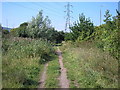
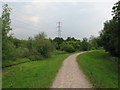
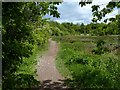
Living in CF23 9WA offers access to a range of amenities within walking or short driving distance. Retail options include Morrisons Penylan, Tesco Cardiff, and Sainsburys Rumney, providing everyday shopping needs. The area’s transport links to the M4 motorway support local businesses, including car showrooms and hotels. For leisure, Coed y Nant park offers a lake, playing fields, and former ancient woodland, ideal for outdoor activities. The Unicorn Inn, a 15th-century pub, and nearby Maelfa Shopping Centre add to the local character. The presence of a health centre, library, and leisure centre further enhances daily life. While the area’s amenities are practical and community-focused, they reflect a suburban balance between convenience and affordability, catering to residents’ needs without excessive luxury.
Amenities
Schools
Near CF23 9WA are two primary schools: Llanedeyrn Primary School and All Saints C.I.W. Primary School. Both are listed as ‘other’ in the data, though their specific educational philosophies or Ofsted ratings are not provided. The presence of two primary schools suggests a basic educational infrastructure for local families, though the absence of secondary schools or specialist institutions may require residents to travel further for higher education. The mix of schools, while limited, could indicate a focus on foundational learning, with parents potentially supplementing with extracurricular activities or private education. For families prioritising proximity to schools, the availability of two primary options is a practical advantage, though the lack of detailed ratings means further research would be needed to assess quality.
| Rank | School | Type | Entry gender | Ages |
|---|
Explore more schools in this area
Go to Schools tabDemographics
The population of CF23 9WA has a median age of 47, with the majority of residents aged 30–64. This suggests a stable, middle-aged demographic, likely with established careers and families. Home ownership stands at 63%, indicating a strong presence of owner-occupied properties, though the remaining 37% may be renters, particularly in the council housing estates. The predominant accommodation type is houses, though the data does not specify the proportion of flats or terraced homes. The predominant ethnic group is White, reflecting the area’s historically low racial diversity. This demographic profile aligns with a community that is neither young nor rapidly changing, offering a consistent, low-deprivation environment. The age range and ownership rates suggest a focus on long-term stability, with fewer transient populations compared to other urban areas.
Household Size
Accommodation Type
Tenure
Ethnic Group
Religion
Household Composition
Age
Household Deprivation
NS-SEC
Explore more demographic insights in this area
Go to Demographics tabPlanning
Planning Constraints
- Flood RiskPremium
- Ramsar Wetland SitesPremium
- Area of Outstanding Natural BeautyPremium
- Protected Nature ReservePremium
- Protected WoodlandPremium
- Crime RiskPremium