Area Overview for CF23 7DT
Photos of CF23 7DT
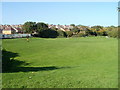
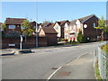
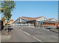
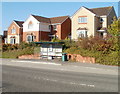
16 photos from this area
Area Information
Key information about the CF23 7DT including its size, population, and administrative classification.
- Area Type
- Postcode
- Area Size
- 6196 m²
- Population
- 1384
- Population Density
- 4339 people/km²
House Prices in CF23 7DT
23
Properties
£112,278
Average Sold Price
£46,000
Lowest Price
£162,500
Highest Price
Showing 23 properties
| Address | Type | Beds | Baths | Last Sale Price | Last Sale Date | |
|---|---|---|---|---|---|---|
| 99 Glyn Rhosyn, Pentwyn, Cardiff, CF23 7DT | Detached | 3 | 2 | £140,000 | May 2011 | |
| 104 Glyn Rhosyn, Pentwyn, Cardiff, CF23 7DT | Semi-detached | 4 | 1 | £162,500 | Feb 2011 | |
| 88 Glyn Rhosyn, Pentwyn, Cardiff, CF23 7DT | house | 3 | 1 | £145,000 | Feb 2011 | |
| 95 Glyn Rhosyn, Pentwyn, Cardiff, CF23 7DT | Semi-detached | 4 | - | £150,000 | Sep 2009 | |
| 98 Glyn Rhosyn, Pentwyn, Cardiff, CF23 7DT | house | - | - | £117,000 | Sep 2003 | |
| 96 Glyn Rhosyn, Pentwyn, Cardiff, CF23 7DT | Semi-detached | 4 | - | £108,500 | Jun 2002 | |
| 108 Glyn Rhosyn, Pentwyn, Cardiff, CF23 7DT | house | - | - | £69,500 | Mar 2001 | |
| 107 Glyn Rhosyn, Pentwyn, Cardiff, CF23 7DT | Semi-detached | - | - | £72,000 | Dec 2000 | |
| 97 Glyn Rhosyn, Pentwyn, Cardiff, CF23 7DT | Semi-detached | - | - | £46,000 | Nov 1995 | |
| 102 Glyn Rhosyn, Pentwyn, Cardiff, CF23 7DT | Semi-detached | 4 | - | - | - |
Page 1 of 3
Energy Efficiency in CF23 7DT
Amenities
Schools
| Rank | School | Type | Entry gender | Ages |
|---|
Explore more schools in this area
Go to Schools tabDemographics
Household Size
Family (3-5 people)
most common
Accommodation Type
Houses
most common
Tenure
80
majority
Ethnic Group
White
most common
Religion
N/A
most common
Household Composition
N/A
most common
Age
47
median
Adults (30-64 years)
most common
Household Deprivation
N/A
with no deprivation
NS-SEC
34
in Lower managerial occupations
Explore more demographic insights in this area
Go to Demographics tabPlanning
Planning Constraints
- Flood RiskPremium
- Ramsar Wetland SitesPremium
- Area of Outstanding Natural BeautyPremium
- Protected Nature ReservePremium
- Protected WoodlandPremium
- Crime RiskPremium