Area Overview for CF23 7DQ
Photos of CF23 7DQ
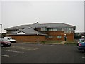
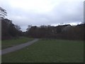
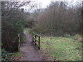
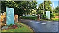
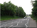
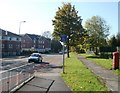
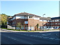
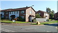
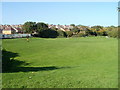
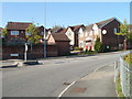
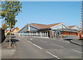
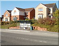
16 photos from this area
Area Information
Key information about the CF23 7DQ including its size, population, and administrative classification.
- Area Type
- Postcode
- Area Size
- 1.1 hectares
- Population
- 1384
- Population Density
- 4339 people/km²
House Prices in CF23 7DQ
28
Properties
£170,833
Average Sold Price
£51,000
Lowest Price
£235,000
Highest Price
Showing 28 properties
| Address | Type | Beds | Baths | Last Sale Price | Last Sale Date | |
|---|---|---|---|---|---|---|
| 82 Ty Cerrig, Pentwyn, Cardiff, CF23 7DQ | Terraced | 3 | 2 | £215,000 | Sep 2025 | |
| 79 Ty Cerrig, Pentwyn, Cardiff, CF23 7DQ | Semi-detached | 3 | 1 | £232,000 | Jul 2024 | |
| 70 Ty Cerrig, Pentwyn, Cardiff, CF23 7DQ | house | - | - | £235,000 | Jan 2023 | |
| 63 Ty Cerrig, Pentwyn, Cardiff, CF23 7DQ | Terraced | - | - | £200,000 | Dec 2019 | |
| 75 Ty Cerrig, Pentwyn, Cardiff, CF23 7DQ | house | - | - | £196,000 | Aug 2019 | |
| 81 Ty Cerrig, Pentwyn, Cardiff, CF23 7DQ | Terraced | 3 | 1 | £173,000 | Jul 2018 | |
| 58 Ty Cerrig, Pentwyn, Cardiff, CF23 7DQ | house | - | - | £180,000 | May 2017 | |
| 74 Ty Cerrig, Pentwyn, Cardiff, CF23 7DQ | Semi-detached | 3 | - | £165,000 | Oct 2016 | |
| 72 Ty Cerrig, Pentwyn, Cardiff, CF23 7DQ | Terraced | 4 | - | £160,000 | Apr 2014 | |
| 64 Ty Cerrig, Pentwyn, Cardiff, CF23 7DQ | Terraced | - | - | £129,000 | Sep 2007 |
Page 1 of 3
Energy Efficiency in CF23 7DQ
Amenities
Schools
| Rank | School | Type | Entry gender | Ages |
|---|
Explore more schools in this area
Go to Schools tabDemographics
Household Size
Family (3-5 people)
most common
Accommodation Type
Houses
most common
Tenure
80
majority
Ethnic Group
White
most common
Religion
N/A
most common
Household Composition
N/A
most common
Age
47
median
Adults (30-64 years)
most common
Household Deprivation
N/A
with no deprivation
NS-SEC
34
in Lower managerial occupations
Explore more demographic insights in this area
Go to Demographics tabPlanning
Planning Constraints
- Flood RiskPremium
- Ramsar Wetland SitesPremium
- Area of Outstanding Natural BeautyPremium
- Protected Nature ReservePremium
- Protected WoodlandPremium
- Crime RiskPremium