Area Overview for CF23 5HP
Photos of CF23 5HP
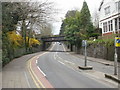
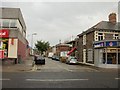
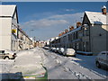


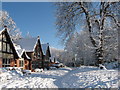


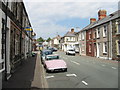

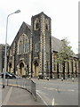

94 photos from this area
Area Information
Key information about the CF23 5HP including its size, population, and administrative classification.
- Area Type
- Postcode
- Area Size
- 8980 m²
- Population
- 1328
- Population Density
- 4721 people/km²
House Prices in CF23 5HP
41
Properties
£330,447
Average Sold Price
£49,834
Lowest Price
£620,000
Highest Price
Showing 41 properties
| Address | Type | Beds | Baths | Last Sale Price | Last Sale Date | |
|---|---|---|---|---|---|---|
| 33 Tydfil Place, Roath, Cardiff, CF23 5HP | house | - | - | £368,000 | Dec 2023 | |
| 5 Tydfil Place, Cardiff, CF23 5HP | Terraced | 4 | 2 | £530,000 | Mar 2023 | |
| 23 Tydfil Place, Roath, Cardiff, CF23 5HP | Terraced | 4 | 2 | £620,000 | Nov 2022 | |
| 3 Tydfil Place, Roath, Cardiff, CF23 5HP | house | - | - | £325,000 | Dec 2021 | |
| 2 Tydfil Place, Roath, Cardiff, CF23 5HP | Terraced | 6 | 2 | £570,000 | Jul 2021 | |
| 31 Tydfil Place, Roath, Cardiff, CF23 5HP | Terraced | 3 | 2 | £415,000 | Jan 2020 | |
| 19 Tydfil Place, Roath, Cardiff, CF23 5HP | Terraced | - | - | £200,000 | Sep 2019 | |
| 6 Tydfil Place, Roath, Cardiff, CF23 5HP | house | - | - | £420,000 | Jun 2019 | |
| 12 Tydfil Place, Roath, Cardiff, CF23 5HP | Terraced | 4 | 2 | £380,000 | Mar 2019 | |
| 20 Tydfil Place, Roath, Cardiff, CF23 5HP | Terraced | 4 | 2 | £400,000 | Sep 2017 |
Page 1 of 5
Energy Efficiency in CF23 5HP
Amenities
Schools
| Rank | School | Type | Entry gender | Ages |
|---|
Explore more schools in this area
Go to Schools tabDemographics
Household Size
One person
most common
Accommodation Type
Flats
most common
Tenure
47
majority
Ethnic Group
White
most common
Religion
N/A
most common
Household Composition
N/A
most common
Age
47
median
Adults (30-64 years)
most common
Household Deprivation
N/A
with no deprivation
NS-SEC
41
in Lower managerial occupations
Explore more demographic insights in this area
Go to Demographics tabPlanning
Planning Constraints
- Flood RiskPremium
- Ramsar Wetland SitesPremium
- Area of Outstanding Natural BeautyPremium
- Protected Nature ReservePremium
- Protected WoodlandPremium
- Crime RiskPremium