Area Overview for CF23 0DG
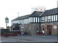
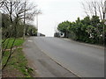
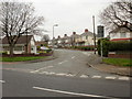
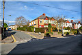
Photos of CF23 0DG


Area Information
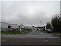
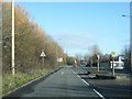
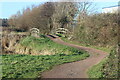
CF23 0DG lies in the eastern part of Cardiff, Wales, within the St Mellons area. This small postcode covers a residential cluster with a population of 2,609 people, spread across 540 residents per square kilometre. Historically, the area was low-lying farmland affected by the Great Flood of 1606, which left seawater in the soil for years. Today, it is a post-war suburban development, with housing estates extending from Rumney in the mid-20th century. The area’s character blends modern housing with remnants of its past, such as the former farms Trowbridge Mawr and Trowbridge Bach, now partially repurposed. While it was once marked by economic deprivation and social challenges in the 1990s, recent improvements in infrastructure and community safety have reshaped its profile. Living here offers proximity to Cardiff’s urban amenities, with rail, bus, and ferry connections to the city centre. The area’s compact size means residents are close to essential services, though its suburban nature ensures a quieter, more residential feel compared to central Cardiff. For those seeking a balance between convenience and a sense of community, CF23 0DG provides a distinct slice of Cardiff’s evolving landscape.
- Area Type
- Postcode
- Area Size
- Not available
- Population
- 2609
- Population Density
- 540 people/km²
The property market in CF23 0DG is characterised by a high rate of home ownership (64%) and a predominance of houses as the primary accommodation type. This indicates a suburban area where family homes are the norm, rather than a rental market or high-density housing. The focus on owner-occupied properties suggests a community of long-term residents, many of whom may have purchased their homes during the post-war housing boom. For buyers, this means a limited selection of properties, as the area is small and compact. The housing stock is likely to include a mix of mid- to large-sized homes, reflecting the suburban character of the area. However, the lack of specific data on property prices or recent developments means buyers should consider the broader Cardiff market for comparable options. The proximity to transport links and amenities may enhance the appeal of properties here, particularly for those seeking a balance between suburban living and urban accessibility.
House Prices in CF23 0DG
No properties found in this postcode.
Energy Efficiency in CF23 0DG
The lifestyle in CF23 0DG is shaped by its proximity to a range of amenities, including five retail stores such as Sainsburys Rumney and Morrisons Penylan, which cater to daily shopping needs. The area’s rail network, with stations like Heath Low Level and Cardiff Queen Street, provides easy access to Cardiff’s urban centres, while the Cardiff Bus Interchange offers connections to other parts of the city. For leisure, five ferry stops, including Taffs Mead Waterbus Stop, provide opportunities for water-based travel and tourism. The presence of these amenities means residents can access shopping, transport, and recreational activities without venturing far. The area’s suburban character, combined with its connectivity, creates a convenient lifestyle, blending quiet living with urban accessibility. The mix of retail, transport, and water-based options ensures that daily life in CF23 0DG is both practical and varied.
Amenities
Schools
The nearest school to CF23 0DG is St John Lloyd R.C. Primary School, which serves the local community. While the data does not provide an Ofsted rating, the presence of a primary school indicates that the area is suitable for families with young children. The school’s religious affiliation (Roman Catholic) may be a consideration for some families, though the data does not specify its academic performance or student outcomes. The absence of secondary schools in the immediate vicinity means that students may need to travel to nearby areas for further education. However, the proximity to Cardiff’s transport network, including rail and bus services, could mitigate this challenge. For families prioritising a strong local school, the availability of a primary school is a positive, though the lack of secondary education options may require careful planning for long-term educational needs.
| Rank | School | Type | Entry gender | Ages |
|---|
Explore more schools in this area
Go to Schools tabDemographics
The community in CF23 0DG is predominantly composed of adults aged 30–64, with a median age of 47. This suggests a mature, stable population, likely with established careers and family structures. Home ownership is high at 64%, indicating a strong presence of owner-occupied properties, which is typical of suburban areas. The accommodation type is primarily houses, reflecting a focus on family homes rather than flats or apartments. The predominant ethnic group is White, though the data does not specify further diversity metrics. The area’s history of economic deprivation in the late 20th century may have influenced its demographic profile, with long-term residents forming a significant portion of the population. However, recent improvements in infrastructure and safety have likely attracted new residents. The age profile implies a community with a mix of active professionals and retirees, creating a balanced social dynamic. For prospective buyers, this suggests a neighbourhood that is both stable and evolving, with a focus on long-term living rather than transient populations.
Household Size
Accommodation Type
Tenure
Ethnic Group
Religion
Household Composition
Age
Household Deprivation
NS-SEC
Explore more demographic insights in this area
Go to Demographics tabPlanning
Planning Constraints
- Flood RiskPremium
- Ramsar Wetland SitesPremium
- Area of Outstanding Natural BeautyPremium
- Protected Nature ReservePremium
- Protected WoodlandPremium
- Crime RiskPremium