Area Overview for CF2 7YF
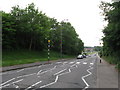
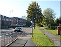
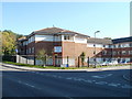
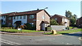
Photos of CF2 7YF
Area Information
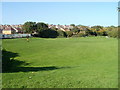
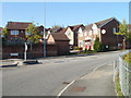
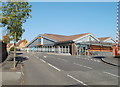
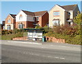
CF2 7YF, a small postcode in Cardiff’s east, lies northeast of the city centre, bordered by Llanedeyrn to the south, Cyncoed to the west, and the River Rhymney to the east. With a population of 2,778, it is a suburban residential cluster shaped by post-war development. The area’s name derives from a historic farm owned by the Kemys-Tynte family, reflecting its rural roots before urbanisation took hold in the late 1960s. Today, it features a mix of prefabricated and terraced houses, flats, and council properties, many of which were originally social housing. The Maelfa Shopping Centre, a focal point since 1974, and Coed y Nant park, with its lake and playing fields, offer local amenities. Proximity to the M4 motorway and nearby rail stations, such as Llanishen and Heath High Level, ensures connectivity to Cardiff’s core and beyond. Living here means balancing suburban tranquillity with access to urban facilities, making it a practical choice for families and commuters.
- Area Type
- Postcode
- Area Size
- Not available
- Population
- 2778
- Population Density
- 5272 people/km²
The property market in CF2 7YF is characterised by a 48% home ownership rate, with houses being the predominant accommodation type. This suggests a mix of owner-occupied properties and rental stock, though the exact proportion of rentals is not specified. The area’s housing stock reflects its post-war origins, featuring prefabricated and terraced homes alongside flats and council properties. This mix caters to both long-term homeowners and tenants, though the relatively low home ownership rate may indicate a reliance on rental options or social housing. For buyers, the small area’s limited size means competition for properties, but the presence of nearby developments like the Maelfa Shopping Centre and Coed y Nant park adds value. The area’s proximity to the M4 and rail stations also enhances its appeal for commuters seeking a balance between suburban living and urban accessibility.
House Prices in CF2 7YF
No properties found in this postcode.
Energy Efficiency in CF2 7YF
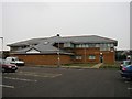
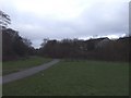
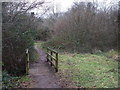
The lifestyle in CF2 7YF is defined by its mix of retail, leisure, and green spaces. Nearby amenities include Aldi Pentwyn, Waitrose Pontprennau, and Lidl Pentwyn, offering everyday shopping needs. The Maelfa Shopping Centre, though partially vacant, remains a hub for commercial activity. Recreational options are plentiful, with Coed y Nant park providing a lake, playing fields, and woodland for outdoor activities. The Pentwyn Leisure Centre, opened in 1989, adds to the area’s appeal for fitness and community events. The proximity to the River Rhymney and nearby waterbus stops also invites leisurely strolls or water-based outings. This blend of practical retail, recreational spaces, and natural features creates a convenient, well-rounded lifestyle for residents, supporting both active and family-oriented pursuits.
Amenities
Schools
Residents of CF2 7YF have access to three primary schools: Bryn Celyn Primary School, St Bernadette’s R.C. Primary School, and The Hollies Special School. All are listed as “other” in the data, though their specific educational focus or Ofsted ratings are not provided. The presence of both mainstream and special needs schools indicates a comprehensive educational offering for families. This variety ensures that children with diverse learning requirements can be accommodated locally, reducing the need for long commutes. The concentration of primary schools also supports the area’s family-oriented demographic, providing parents with multiple options for their children’s early education. While secondary schools are not listed, the proximity to larger Cardiff districts likely offers nearby secondary education choices.
| Rank | School | Type | Entry gender | Ages |
|---|
Explore more schools in this area
Go to Schools tabDemographics
The community in CF2 7YF is predominantly composed of adults aged 30–64, with a median age of 47. Home ownership stands at 48%, reflecting a mix of long-term residents who may have bought their homes through right-to-buy schemes and those in social housing. The area is largely homogenous, with the White ethnic group forming the majority. This demographic profile suggests a stable, middle-aged population likely focused on family life and long-term residency. The absence of specific deprivation data means no direct insights into economic challenges, but the age range and home ownership rate imply a community with established routines and local ties. The presence of five primary schools also indicates a family-oriented environment, supporting children’s education from an early age.
Household Size
Accommodation Type
Tenure
Ethnic Group
Religion
Household Composition
Age
Household Deprivation
NS-SEC
Explore more demographic insights in this area
Go to Demographics tabPlanning
Planning Constraints
- Flood RiskPremium
- Ramsar Wetland SitesPremium
- Area of Outstanding Natural BeautyPremium
- Protected Nature ReservePremium
- Protected WoodlandPremium
- Crime RiskPremium