Area Overview for CF15 8DX
Photos of CF15 8DX
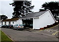
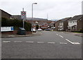
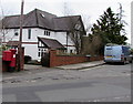
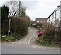
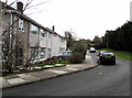
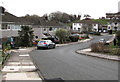
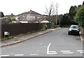
85 photos from this area
Area Information
Key information about the CF15 8DX including its size, population, and administrative classification.
- Area Type
- Postcode
- Area Size
- 7.8 hectares
- Population
- 2291
- Population Density
- 998 people/km²
House Prices in CF15 8DX
20
Properties
£579,478
Average Sold Price
£28,500
Lowest Price
£935,000
Highest Price
Showing 20 properties
| Address | Type | Beds | Baths | Last Sale Price | Last Sale Date | |
|---|---|---|---|---|---|---|
| 117 Heol Isaf, Radyr, Cardiff, CF15 8DX | Retail | 5 | 3 | £690,000 | May 2022 | |
| 135 Heol Isaf, Radyr, Cardiff, CF15 8DX | Detached | 5 | 3 | £620,000 | Jan 2021 | |
| 145 Heol Isaf, Radyr, Cardiff, CF15 8DX | house | - | - | £935,000 | Aug 2019 | |
| 143 Heol Isaf, Radyr, Cardiff, CF15 8DX | house | - | - | £855,000 | Nov 2018 | |
| 139 Heol Isaf, Radyr, Cardiff, CF15 8DX | house | - | - | £581,275 | Jul 2018 | |
| Holly House, Heol Isaf, Radyr, Cardiff, CF15 8DX | Detached | 5 | 3 | £645,000 | Jan 2017 | |
| 151 Heol Isaf, Radyr, Cardiff, CF15 8DX | house | - | - | £695,000 | Sep 2016 | |
| 137 Heol Isaf, Radyr, Cardiff, CF15 8DX | house | - | - | £370,000 | May 2008 | |
| 115 Heol Isaf, Radyr, Cardiff, CF15 8DX | Detached | 4 | - | £375,000 | Sep 2002 | |
| Hafod Y Ddinas, Heol Isaf, Radyr, Cardiff, CF15 8DX | Detached | 6 | 3 | £28,500 | Aug 1998 |
Page 1 of 2
Energy Efficiency in CF15 8DX
Amenities
Schools
| Rank | School | Type | Entry gender | Ages |
|---|
Explore more schools in this area
Go to Schools tabDemographics
Household Size
Family (3-5 people)
most common
Accommodation Type
Houses
most common
Tenure
76
majority
Ethnic Group
White
most common
Religion
N/A
most common
Household Composition
N/A
most common
Age
47
median
Adults (30-64 years)
most common
Household Deprivation
N/A
with no deprivation
NS-SEC
61
in Lower managerial occupations
Explore more demographic insights in this area
Go to Demographics tabPlanning
Planning Constraints
- Flood RiskPremium
- Ramsar Wetland SitesPremium
- Area of Outstanding Natural BeautyPremium
- Protected Nature ReservePremium
- Protected WoodlandPremium
- Crime RiskPremium