Area Overview for CF15 7LF
Photos of CF15 7LF
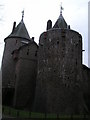


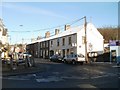


100 photos from this area
Area Information
Key information about the CF15 7LF including its size, population, and administrative classification.
- Area Type
- Postcode
- Area Size
- 1.1 hectares
- Population
- 1846
- Population Density
- 431 people/km²
House Prices in CF15 7LF
25
Properties
£208,938
Average Sold Price
£142,500
Lowest Price
£310,000
Highest Price
Showing 25 properties
| Address | Type | Beds | Baths | Last Sale Price | Last Sale Date | |
|---|---|---|---|---|---|---|
| 45 Merthyr Road, Tongwynlais, Cardiff, CF15 7LF | house | - | - | £220,000 | Apr 2024 | |
| 39 Merthyr Road, Tongwynlais, Cardiff, CF15 7LF | Terraced | 3 | 1 | £237,500 | May 2023 | |
| 43 Merthyr Road, Tongwynlais, Cardiff, CF15 7LF | Terraced | 4 | 1 | £310,000 | Nov 2022 | |
| 3 Merthyr Road, Tongwynlais, Cardiff, CF15 7LF | Terraced | 4 | 2 | £295,000 | May 2016 | |
| 25 Merthyr Road, Tongwynlais, Cardiff, CF15 7LF | Cottage | 3 | - | £142,500 | Nov 2011 | |
| 29 Merthyr Road, Tongwynlais, Cardiff, CF15 7LF | Terraced | - | - | £147,500 | Jan 2008 | |
| 15 Merthyr Road, Tongwynlais, Cardiff, CF15 7LF | Terraced | - | - | £168,000 | May 2007 | |
| 27 Merthyr Road, Tongwynlais, Cardiff, CF15 7LF | Terraced | - | - | £151,000 | Oct 2006 | |
| 41 Merthyr Road, Tongwynlais, Cardiff, CF15 7LF | Terraced | 5 | 1 | - | - | |
| 37 Merthyr Road, Tongwynlais, Cardiff, CF15 7LF | Terraced | 3 | 1 | - | - |
Page 1 of 3
Energy Efficiency in CF15 7LF
Amenities
Schools
| Rank | School | Type | Entry gender | Ages |
|---|
Explore more schools in this area
Go to Schools tabDemographics
Household Size
Family (3-5 people)
most common
Accommodation Type
Houses
most common
Tenure
70
majority
Ethnic Group
White
most common
Religion
N/A
most common
Household Composition
N/A
most common
Age
47
median
Adults (30-64 years)
most common
Household Deprivation
N/A
with no deprivation
NS-SEC
42
in Lower managerial occupations
Explore more demographic insights in this area
Go to Demographics tabPlanning
Planning Constraints
- Flood RiskPremium
- Ramsar Wetland SitesPremium
- Area of Outstanding Natural BeautyPremium
- Protected Nature ReservePremium
- Protected WoodlandPremium
- Crime RiskPremium