Area Overview for CF14 7YF
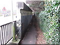
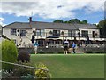
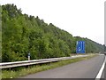
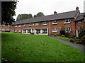
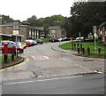
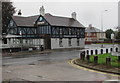
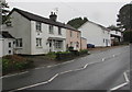
Photos of CF14 7YF
Area Information
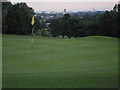
CF14 7YF is a compact residential postcode in Cardiff, Wales, with a population of 1,633 people spread across 1.36 km². The area’s name originates from St. Mary’s chapel, a historic site that once stood on Old Church Road. This small cluster lies in the northwest of Cardiff, near the River Taff, which historically powered medieval mills and shaped the region’s development. Today, the area blends modern living with traces of its past, including the 19th-century Whitchurch Methodist Church and remnants of 18th-century agricultural roots. With a population density of 1,201 people per km², the community is tight-knit, centred around local amenities and transport links. Residents benefit from proximity to rail services, retail hubs, and waterbus routes, making it accessible for both daily commutes and leisure. The area’s compact size means a strong sense of locality, with neighbours likely to know each other. For those seeking a balance between urban convenience and historical character, CF14 7YF offers a distinct slice of Cardiff life.
- Area Type
- Postcode
- Area Size
- Not available
- Population
- 1633
- Population Density
- 1201 people/km²
The property market in CF14 7YF is characterised by a 47% home ownership rate, meaning that over half of properties are rented. This suggests a rental market with a significant proportion of tenants, possibly attracting professionals or families seeking flexibility. The predominant accommodation type is flats, which are common in densely populated urban areas. Given the postcode’s small size and high population density, housing stock is likely limited to multi-unit developments, with fewer detached or semi-detached homes. For buyers, this means competition for available properties, particularly in a market where demand may outstrip supply. The area’s proximity to transport links and amenities could make it appealing to investors, though the compact nature of the postcode means buyers should consider nearby areas for more options. The mix of rental and ownership indicates a dynamic market, but the lack of specific data on property prices or trends leaves room for further research.
House Prices in CF14 7YF
No properties found in this postcode.
Energy Efficiency in CF14 7YF
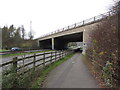
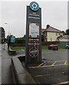
Living in CF14 7YF offers access to a range of amenities within practical reach. Retail options include five nearby stores, such as Asda Cardiff and Morrisons Daily Cardiff, catering to everyday shopping needs. For transport, residents can use five rail stations, including Coryton and Whitchurch, along with waterbus stops like Taffs Mead and Channel View, which connect to Cardiff’s waterfront. The Cardiff Bus Interchange provides additional mobility. While the area lacks parks or leisure facilities in the data, its proximity to the River Taff and historical sites like Castell Coch suggests opportunities for outdoor activities. The presence of multiple retail and transport hubs indicates a lifestyle focused on convenience and connectivity, ideal for those prioritising accessibility over expansive green spaces. The compact nature of the postcode means amenities are closely grouped, reducing travel time for daily tasks.
Amenities
Schools
The nearest school to CF14 7YF is Coryton Primary School, categorised as an ‘other’ type in the data. No Ofsted rating is provided, so its performance cannot be assessed here. The presence of a primary school suggests the area is suitable for families with young children, though the absence of secondary schools or additional educational institutions may require residents to travel further for higher education. The single listed school indicates a limited range of educational options, which could be a consideration for families prioritising a variety of schooling choices. Without further data on school catchment areas or student outcomes, prospective residents should investigate local education provision independently. The compact nature of the postcode may also mean that schools are shared with nearby areas, influencing availability and capacity.
| Rank | School | Type | Entry gender | Ages |
|---|
Explore more schools in this area
Go to Schools tabDemographics
The median age in CF14 7YF is 47, with the majority of residents falling into the 30-64 age range. Home ownership rates are 47%, indicating that over half of properties are rented, reflecting a mix of owner-occupied and rental housing. The predominant accommodation type is flats, suggesting a higher proportion of multi-unit buildings compared to detached homes. The ethnic composition is largely White, though specific diversity statistics are not provided. The age profile suggests a mature community, potentially with a focus on stability and long-term residency. With no data on deprivation levels, it is unclear how economic factors might influence quality of life. However, the presence of amenities like retail centres and transport links implies accessibility for daily needs. The population density of 1,201 people per km² means a relatively compact living environment, which may foster community interaction but could also impact space per household.
Household Size
Accommodation Type
Tenure
Ethnic Group
Religion
Household Composition
Age
Household Deprivation
NS-SEC
Explore more demographic insights in this area
Go to Demographics tabPlanning
Planning Constraints
- Flood RiskPremium
- Ramsar Wetland SitesPremium
- Area of Outstanding Natural BeautyPremium
- Protected Nature ReservePremium
- Protected WoodlandPremium
- Crime RiskPremium