Area Overview for CF14 7XB
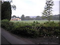
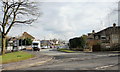
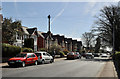
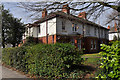
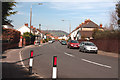
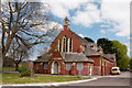
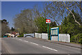
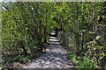
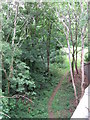
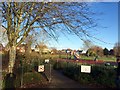
Photos of CF14 7XB

Area Information
CF14 7XB is a compact residential postcode in Wales, covering 5.2 hectares and home to 1,633 residents. Its population density of 1,201 people per square kilometre reflects a tightly knit community, typical of its small-scale nature. The area is part of Whitchurch, a civil parish in Cardiff with a history stretching back over a millennium. Named for St. Mary’s chapel, which once stood on Old Church Road, the area has long been shaped by the River Taff and medieval mills. Today, it blends historical roots with modern living, offering proximity to Cardiff’s urban amenities while retaining a village-like character. Residents benefit from a mix of transport options, including five nearby railway stations and ferry services along the River Taff. The area’s compact size means daily life is centred on local amenities, with shops, schools, and community landmarks within easy reach. For those seeking a balance between history and convenience, CF14 7XB provides a distinct slice of Cardiff’s north-western edge.
- Area Type
- Postcode
- Area Size
- 5.2 hectares
- Population
- 1633
- Population Density
- 1201 people/km²
CF14 7XB’s property market is characterised by a 47% home ownership rate, with flats making up the majority of accommodation. This suggests a rental market that complements owner-occupied properties, likely catering to younger families or professionals seeking manageable living spaces. The compact size of the postcode means housing stock is limited, and buyers should consider nearby areas for broader options. Flats in this area may benefit from proximity to transport links, including five railway stations and ferry services, which could enhance their appeal. However, the small size of CF14 7XB means competition for properties may be fierce, and buyers should prioritise locations with direct access to amenities like schools and retail. The predominance of flats also implies a focus on shared spaces and community living, which may align with the area’s historical village-like feel.
House Prices in CF14 7XB
Showing 6 properties
Energy Efficiency in CF14 7XB
Living in CF14 7XB offers access to a range of amenities within practical reach. Retailers such as Tesco Whitchurch, Iceland Cardiff, and Co-op Whitchurch provide everyday shopping needs, while ferry stops like Cardiff Castle Waterbus Stop and Taffs Mead Waterbus Stop offer scenic river travel. The area’s proximity to historical sites like St. Mary’s Church and Whitchurch Methodist Church adds cultural depth to daily life. Though the data does not mention parks or leisure facilities, the nearby Castell Coch (the Red Castle) suggests opportunities for heritage tourism. The compact nature of the postcode means amenities are concentrated, fostering a community-oriented lifestyle. Residents can enjoy a mix of practical conveniences and historical richness, with transport links ensuring easy access to Cardiff’s broader offerings.
Amenities
Schools
The nearest school to CF14 7XB is Coryton Primary School, listed as an "other" type in the data. While no Ofsted rating is provided, the presence of a primary school within the area suggests it is a family-friendly location. The absence of secondary schools nearby may require families to consider commuting to larger districts like Cardiff’s city centre or surrounding suburbs. The school’s type and lack of detailed performance metrics mean prospective buyers should investigate further through local education authorities or parental reviews. For those prioritising schools, the area’s proximity to transport links could ease access to broader educational networks. However, the limited data on schools means buyers must rely on additional research to assess their suitability for their needs.
| Rank | School | Type | Entry gender | Ages |
|---|
Explore more schools in this area
Go to Schools tabDemographics
The population of CF14 7XB is predominantly adults aged 30–64, with a median age of 47. This suggests a mature, stable community, likely with established families and professionals. Home ownership stands at 47%, indicating a mix of owner-occupied and rental properties. The accommodation type is primarily flats, reflecting a housing stock suited to smaller households or those prioritising convenience over larger homes. The predominant ethnic group is White, with no specific data on diversity beyond this. While deprivation data is not provided, the high population density and reliance on rental housing may suggest a need for targeted local services. However, the area’s proximity to transport and amenities could mitigate some challenges. The presence of a primary school and historical landmarks also hints at a community that values both practicality and heritage.
Household Size
Accommodation Type
Tenure
Ethnic Group
Religion
Household Composition
Age
Household Deprivation
NS-SEC
Explore more demographic insights in this area
Go to Demographics tabPlanning
Planning Constraints
- Flood RiskPremium
- Ramsar Wetland SitesPremium
- Area of Outstanding Natural BeautyPremium
- Protected Nature ReservePremium
- Protected WoodlandPremium
- Crime RiskPremium