Area Overview for CF14 5UU
Photos of CF14 5UU
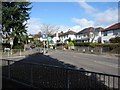
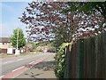
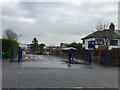
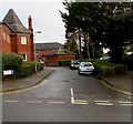
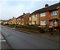
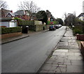
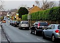
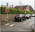
30 photos from this area
Area Information
Key information about the CF14 5UU including its size, population, and administrative classification.
- Area Type
- Postcode
- Area Size
- 1.6 hectares
- Population
- 1254
- Population Density
- 1970 people/km²
House Prices in CF14 5UU
15
Properties
£607,938
Average Sold Price
£60,000
Lowest Price
£2,105,000
Highest Price
Showing 15 properties
| Address | Type | Beds | Baths | Last Sale Price | Last Sale Date | |
|---|---|---|---|---|---|---|
| Cartref, 85-91 Station Road, Llanishen, Cardiff, CF14 5UU | hospital_care_home | - | - | £2,105,000 | Nov 2023 | |
| 71 Station Road, Llanishen, Cardiff, CF14 5UU | house | - | - | £540,000 | Sep 2023 | |
| 79 Station Road, Llanishen, Cardiff, CF14 5UU | house | - | - | £465,000 | Jul 2013 | |
| 95 Station Road, Llanishen, Cardiff, CF14 5UU | Semi-detached | - | - | £477,500 | Apr 2012 | |
| 93 Station Road, Llanishen, Cardiff, CF14 5UU | Semi-detached | - | - | £458,000 | Nov 2008 | |
| 73 Station Road, Llanishen, Cardiff, CF14 5UU | Semi-detached | - | - | £435,000 | Jun 2007 | |
| Elgin House, 77 Station Road, Llanishen, Cardiff, CF14 5UU | house | - | - | £323,000 | May 2002 | |
| 81A Station Road, Llanishen, Cardiff, CF14 5UU | Maisonette | - | - | £60,000 | Mar 2000 | |
| Fraser House, 85-87 Station Road, Llanishen, Cardiff, CF14 5UU | Retirement | - | - | - | - | |
| Thomas House, 89-91 Station Road, Llanishen, Cardiff, CF14 5UU | Retirement | - | - | - | - |
Page 1 of 2
Energy Efficiency in CF14 5UU
Amenities
Schools
| Rank | School | Type | Entry gender | Ages |
|---|
Explore more schools in this area
Go to Schools tabDemographics
Household Size
Two person
most common
Accommodation Type
Houses
most common
Tenure
87
majority
Ethnic Group
White
most common
Religion
N/A
most common
Household Composition
N/A
most common
Age
47
median
Adults (30-64 years)
most common
Household Deprivation
N/A
with no deprivation
NS-SEC
53
in Lower managerial occupations
Explore more demographic insights in this area
Go to Demographics tabPlanning
Planning Constraints
- Flood RiskPremium
- Ramsar Wetland SitesPremium
- Area of Outstanding Natural BeautyPremium
- Protected Nature ReservePremium
- Protected WoodlandPremium
- Crime RiskPremium