Area Overview for CF14 4LT
Photos of CF14 4LT
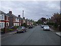
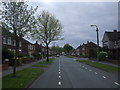
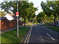

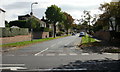
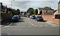
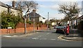

79 photos from this area
Area Information
Key information about the CF14 4LT including its size, population, and administrative classification.
- Area Type
- Postcode
- Area Size
- 1.5 hectares
- Population
- 1593
- Population Density
- 4500 people/km²
House Prices in CF14 4LT
38
Properties
£284,352
Average Sold Price
£74,000
Lowest Price
£435,000
Highest Price
Showing 38 properties
| Address | Type | Beds | Baths | Last Sale Price | Last Sale Date | |
|---|---|---|---|---|---|---|
| 53 St Ina Road, Heath, Cardiff, CF14 4LT | Semi-detached | 3 | 1 | £427,500 | Mar 2025 | |
| 48 St Ina Road, Heath, Cardiff, CF14 4LT | house | - | - | £380,000 | Feb 2023 | |
| 67 St Ina Road, Heath, Cardiff, CF14 4LT | house | - | - | £435,000 | Dec 2022 | |
| 80 St Ina Road, Heath, Cardiff, CF14 4LT | house | - | - | £367,000 | Apr 2019 | |
| 57 St Ina Road, Heath, Cardiff, CF14 4LT | Semi-detached | 5 | 3 | £392,000 | Apr 2019 | |
| 63B St Ina Road, Heath, Cardiff, CF14 4LT | house | - | - | £430,000 | Jan 2019 | |
| 71 St Ina Road, Heath, Cardiff, CF14 4LT | Semi-detached | 4 | 2 | £404,000 | Oct 2018 | |
| 60 St Ina Road, Heath, Cardiff, CF14 4LT | Semi-detached | 3 | 2 | £400,000 | Dec 2017 | |
| 68 St Ina Road, Heath, Cardiff, CF14 4LT | house | - | - | £365,000 | Mar 2017 | |
| 69 St Ina Road, Heath, Cardiff, CF14 4LT | Semi-detached | 3 | 1 | £315,000 | Mar 2015 |
Page 1 of 4
Energy Efficiency in CF14 4LT
Amenities
Schools
| Rank | School | Type | Entry gender | Ages |
|---|
Explore more schools in this area
Go to Schools tabDemographics
Household Size
Family (3-5 people)
most common
Accommodation Type
Houses
most common
Tenure
94
majority
Ethnic Group
White
most common
Religion
N/A
most common
Household Composition
N/A
most common
Age
47
median
Adults (30-64 years)
most common
Household Deprivation
N/A
with no deprivation
NS-SEC
59
in Lower managerial occupations
Explore more demographic insights in this area
Go to Demographics tabPlanning
Planning Constraints
- Flood RiskPremium
- Ramsar Wetland SitesPremium
- Area of Outstanding Natural BeautyPremium
- Protected Nature ReservePremium
- Protected WoodlandPremium
- Crime RiskPremium