Area Overview for CF14 4BH
Photos of CF14 4BH
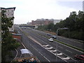


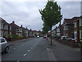
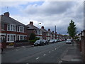
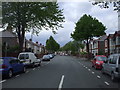


100 photos from this area
Area Information
Key information about the CF14 4BH including its size, population, and administrative classification.
- Area Type
- Postcode
- Area Size
- 1.2 hectares
- Population
- 1401
- Population Density
- 6055 people/km²
House Prices in CF14 4BH
30
Properties
£256,520
Average Sold Price
£70,000
Lowest Price
£425,000
Highest Price
Showing 30 properties
| Address | Type | Beds | Baths | Last Sale Price | Last Sale Date | |
|---|---|---|---|---|---|---|
| 67 St Ambrose Road, Heath, Cardiff, CF14 4BH | Bungalow | 2 | - | £375,000 | Jun 2021 | |
| 52 St Ambrose Road, Heath, Cardiff, CF14 4BH | house | - | - | £350,000 | Apr 2021 | |
| 65 St Ambrose Road, Heath, Cardiff, CF14 4BH | Semi-detached | 3 | - | £370,000 | Jan 2019 | |
| 41 St. Ambrose Road, Cardiff, CF14 4BH | Detached | 3 | 2 | £425,000 | Mar 2018 | |
| 35 St Ambrose Road, Heath, Cardiff, CF14 4BH | Detached | 3 | 2 | £300,000 | Jul 2015 | |
| 68 St Ambrose Road, Heath, Cardiff, CF14 4BH | house | - | - | £260,000 | Apr 2015 | |
| 58 St Ambrose Road, Heath, Cardiff, CF14 4BH | house | - | - | £244,000 | Jul 2013 | |
| 62 St Ambrose Road, Heath, Cardiff, CF14 4BH | Semi-detached | 3 | 1 | £268,000 | May 2013 | |
| 56 St Ambrose Road, Heath, Cardiff, CF14 4BH | Semi-detached | 3 | - | £250,000 | May 2013 | |
| 60 St Ambrose Road, Heath, Cardiff, CF14 4BH | house | - | - | £249,000 | Jul 2012 |
Page 1 of 3
Energy Efficiency in CF14 4BH
Amenities
Schools
| Rank | School | Type | Entry gender | Ages |
|---|
Explore more schools in this area
Go to Schools tabDemographics
Household Size
Family (3-5 people)
most common
Accommodation Type
Houses
most common
Tenure
93
majority
Ethnic Group
White
most common
Religion
N/A
most common
Household Composition
N/A
most common
Age
47
median
Adults (30-64 years)
most common
Household Deprivation
N/A
with no deprivation
NS-SEC
52
in Lower managerial occupations
Explore more demographic insights in this area
Go to Demographics tabPlanning
Planning Constraints
- Flood RiskPremium
- Ramsar Wetland SitesPremium
- Area of Outstanding Natural BeautyPremium
- Protected Nature ReservePremium
- Protected WoodlandPremium
- Crime RiskPremium