Area Overview for CF14 3BG
Photos of CF14 3BG
Area Information
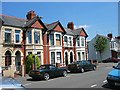
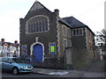
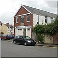
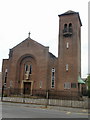
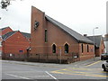
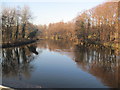
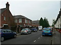
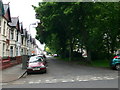
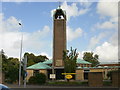
CF14 3BG lies in Gabalfa, a district in north Cardiff, Wales, where the A48, A470, and A469 converge at the Gabalfa Interchange. This small postcode area, home to 1,456 residents, is defined by terraced housing and a strong student presence, with nearly 3,100 students from Cardiff University living in nearby halls. The area’s history as a ferry crossing site has evolved into a modern urban residential cluster, bounded by Birchgrove, Heath, and Cathays. Daily life here is shaped by proximity to the city centre, with a 30-minute walk or 10-minute cycle to Cardiff’s core. The community is tightly knit, with residents prioritising neighbourly connections despite calls for more youth facilities. Key landmarks include St. Joseph’s Church, the Colonies’ colonial-named streets, and Cathays High School. The area’s transport links, including multiple rail and waterbus stops, make it a practical base for commuters and students alike.
- Area Type
- Postcode
- Area Size
- Not available
- Population
- 1456
- Population Density
- 7961 people/km²
CF14 3BG is predominantly a rental market, with 49% of residents owning their homes and the rest renting, often in terraced housing. The area’s housing stock includes both private rentals and council properties, reflecting its role as a student and young professional hub. Terraced homes dominate, a legacy of 19th-century development, though newer builds are limited. For buyers, the small postcode area means competition is concentrated, with properties often prioritised by proximity to transport and universities. The mix of rental and owner-occupied homes creates a dynamic market, but the limited size of the area means buyers must consider nearby suburbs for more options. The presence of Cardiff University halls also influences demand, with properties near campuses seeing higher turnover.
House Prices in CF14 3BG
No properties found in this postcode.
Energy Efficiency in CF14 3BG
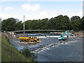
Residents of CF14 3BG have access to a range of amenities within easy reach. Retail options include Co-op Whitchurch, Tesco Cardiff, and Aldi Batchelor, while rail links to Heath Low Level, Heath High Level, and Cathays stations provide direct access to Cardiff’s transport network. Waterbus stops near Cardiff Castle and Taffs Mead offer leisurely travel along the River Taff. The area is within walking distance of Cathays High School and Cardiff University halls, including Liberty House near the University Hospital of Wales. The Colonies’ colonial-named streets, such as Australia Road and Newfoundland Road, add historical character. Despite its small size, the area balances convenience with a sense of community, with nearby parks and social spaces fostering local connections.
Amenities
Schools
| Rank | School | Type | Entry gender | Ages |
|---|
Explore more schools in this area
Go to Schools tabDemographics
CF14 3BG has a median age of 22, with the majority of residents aged 15–29. This reflects the area’s role as a student hub, with Cardiff University halls housing thousands nearby. Home ownership stands at 49%, meaning over half of residents rent, often in terraced housing. The predominant ethnic group is White, and the area’s demographics align with its young, transient population. The high proportion of young adults shapes the local culture, with a focus on education and social connectivity. While no deprivation data is provided, the presence of council estates and private rentals suggests a mix of household types. The area’s character is defined by its student population, which influences local amenities and community dynamics.
Household Size
Accommodation Type
Tenure
Ethnic Group
Religion
Household Composition
Age
Household Deprivation
NS-SEC
Explore more demographic insights in this area
Go to Demographics tabPlanning
Planning Constraints
- Flood RiskPremium
- Ramsar Wetland SitesPremium
- Area of Outstanding Natural BeautyPremium
- Protected Nature ReservePremium
- Protected WoodlandPremium
- Crime RiskPremium