Area Overview for CF14 2XG
Photos of CF14 2XG


Area Information
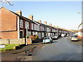
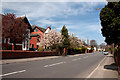
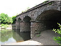
CF14 2XG is a small residential postcode in Cardiff, Wales, encompassing the historic parish of Whitchurch. With a population of 1,622, it is a tightly knit community centred around the River Taff, where medieval mills once operated. The area’s name derives from St. Mary’s chapel, historically known as the “white chapel,” and its roots stretch back to 1126, when it was mentioned in the Agreement of Woodstock. Today, the area is characterised by a cluster of homes, many of which are owner-occupied, reflecting a stable, long-term resident base. The landscape is shaped by its proximity to the River Taff and its historical ties to the Bute family, who once controlled much of the land. Living here offers a blend of historical significance and modern convenience, with easy access to transport networks, retail, and leisure amenities. The area’s compact size means residents are close to key services, while its low flood risk and absence of environmental constraints make it a practical choice for those seeking a balanced lifestyle in a historically rich setting.
- Area Type
- Postcode
- Area Size
- Not available
- Population
- 1622
- Population Density
- 3870 people/km²
The property market in CF14 2XG is dominated by owner-occupied homes, with 91% of properties owned by residents rather than rented. This high ownership rate suggests a community of long-term residents who value stability and investment in their homes. The accommodation type is primarily houses, which is typical for smaller, established areas like Whitchurch. This contrasts with regions where flats or apartments predominate, and it may indicate a preference for family-friendly, single-unit dwellings. The small size of the postcode means the housing stock is limited, and buyers should consider the immediate surrounding areas for more options. For those seeking a home in CF14 2XG, the market is likely to be competitive, with properties retaining value due to the area’s low environmental risks and historical appeal. The absence of rental properties also means the area is less likely to attract transient populations, reinforcing its character as a settled community.
House Prices in CF14 2XG
No properties found in this postcode.
Energy Efficiency in CF14 2XG
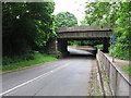
Residents of CF14 2XG have access to a range of nearby amenities that cater to daily needs and leisure. Retail options include Tesco Whitchurch, Iceland Cardiff, and Co-op Whitchurch, providing essential shopping within practical reach. The area’s proximity to the River Taff and historical sites like St. Mary’s Church and Castell Coch adds cultural and recreational value. For transport, five railway stations and ferry stops offer easy access to Cardiff’s urban core and waterways. The nearby Cardiff Bus Interchange further expands connectivity. The area’s compact size means amenities are closely clustered, reducing travel time for errands and social activities. This convenience, combined with the historical character of the parish, creates a lifestyle that balances practicality with a sense of place. Whether shopping, commuting, or exploring local landmarks, residents benefit from a well-served environment that supports both routine and leisure.
Amenities
Schools
| Rank | School | Type | Entry gender | Ages |
|---|
Explore more schools in this area
Go to Schools tabDemographics
The community in CF14 2XG is predominantly composed of adults aged 30–64, with a median age of 47. This suggests a mature, established population, many of whom may have lived in the area for decades. Home ownership is exceptionally high at 91%, indicating a strong sense of local attachment and stability. The accommodation type is primarily houses, which aligns with the area’s residential character and the absence of high-density housing. The predominant ethnic group is White, reflecting the broader demographic patterns of the region. While specific data on deprivation is not provided, the high home ownership rate and the presence of long-standing infrastructure suggest a relatively stable quality of life. The age profile implies a community with a mix of working-age individuals and retirees, potentially supporting local services and amenities. The absence of significant diversity data means the area’s social composition remains largely homogenous, though this does not necessarily indicate a lack of inclusivity.
Household Size
Accommodation Type
Tenure
Ethnic Group
Religion
Household Composition
Age
Household Deprivation
NS-SEC
Explore more demographic insights in this area
Go to Demographics tabPlanning
Planning Constraints
- Flood RiskPremium
- Ramsar Wetland SitesPremium
- Area of Outstanding Natural BeautyPremium
- Protected Nature ReservePremium
- Protected WoodlandPremium
- Crime RiskPremium