Area Overview for CF14 2LR
Photos of CF14 2LR

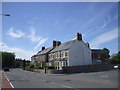
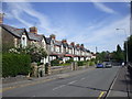

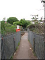
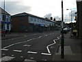
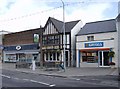
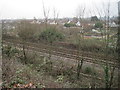


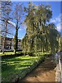

22 photos from this area
Area Information
Key information about the CF14 2LR including its size, population, and administrative classification.
- Area Type
- Postcode
- Area Size
- 4.0 hectares
- Population
- 1535
- Population Density
- 3135 people/km²
House Prices in CF14 2LR
23
Properties
£223,390
Average Sold Price
£38,000
Lowest Price
£425,000
Highest Price
Showing 23 properties
| Address | Type | Beds | Baths | Last Sale Price | Last Sale Date | |
|---|---|---|---|---|---|---|
| 33 Hawthorn Road East, Llandaff North, Cardiff, CF14 2LR | Semi-detached | 5 | 3 | £425,000 | Oct 2025 | |
| 3 Hawthorn Road East, Llandaff North, Cardiff, CF14 2LR | Terraced | 2 | 1 | £261,000 | Dec 2024 | |
| 29 Hawthorn Road East, Llandaff North, Cardiff, CF14 2LR | house | - | - | £280,000 | Nov 2023 | |
| 11 Hawthorn Road East, Llandaff North, Cardiff, CF14 2LR | Terraced | 3 | 1 | £285,000 | Jun 2023 | |
| 5 Hawthorn Road East, Llandaff North, Cardiff, CF14 2LR | house | - | - | £315,250 | Jun 2022 | |
| 19 Hawthorn Road East, Llandaff North, Cardiff, CF14 2LR | Terraced | 2 | 1 | £315,000 | Jun 2022 | |
| 35 Hawthorn Road East, Llandaff North, Cardiff, CF14 2LR | Semi-detached | 3 | 1 | £307,500 | Nov 2019 | |
| 15 Hawthorn Road East, Llandaff North, Cardiff, CF14 2LR | Terraced | 3 | 1 | £188,500 | May 2019 | |
| 37 Hawthorn Road East, Llandaff North, Cardiff, CF14 2LR | house | - | - | £281,100 | Aug 2016 | |
| 31 Hawthorn Road East, Llandaff North, Cardiff, CF14 2LR | house | - | - | £150,000 | Oct 2013 |
Page 1 of 3
Energy Efficiency in CF14 2LR
Amenities
Schools
| Rank | School | Type | Entry gender | Ages |
|---|
Explore more schools in this area
Go to Schools tabDemographics
Household Size
One person
most common
Accommodation Type
Houses
most common
Tenure
73
majority
Ethnic Group
White
most common
Religion
N/A
most common
Household Composition
N/A
most common
Age
47
median
Adults (30-64 years)
most common
Household Deprivation
N/A
with no deprivation
NS-SEC
47
in Lower managerial occupations
Explore more demographic insights in this area
Go to Demographics tabPlanning
Planning Constraints
- Flood RiskPremium
- Ramsar Wetland SitesPremium
- Area of Outstanding Natural BeautyPremium
- Protected Nature ReservePremium
- Protected WoodlandPremium
- Crime RiskPremium