Area Overview for CF14 1UN
Photos of CF14 1UN
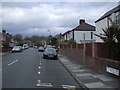
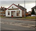

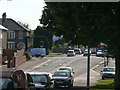
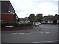
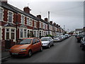
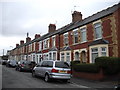

93 photos from this area
Area Information
Key information about the CF14 1UN including its size, population, and administrative classification.
- Area Type
- Postcode
- Area Size
- 9546 m²
- Population
- 1399
- Population Density
- 4781 people/km²
House Prices in CF14 1UN
24
Properties
£314,569
Average Sold Price
£147,500
Lowest Price
£470,000
Highest Price
Showing 24 properties
| Address | Type | Beds | Baths | Last Sale Price | Last Sale Date | |
|---|---|---|---|---|---|---|
| 4 Pantbach Place, Heath, Cardiff, CF14 1UN | Bungalow | 3 | 1 | £470,000 | Mar 2023 | |
| 13 Pantbach Place, Heath, Cardiff, CF14 1UN | Bungalow | - | - | £349,950 | Jul 2022 | |
| 16 Pantbach Place, Heath, Cardiff, CF14 1UN | Bungalow | 2 | - | £367,000 | Feb 2022 | |
| 14 Pantbach Place, Heath, Cardiff, CF14 1UN | Bungalow | - | - | £450,000 | Oct 2021 | |
| 11 Pantbach Place, Heath, Cardiff, CF14 1UN | Bungalow | 4 | 1 | £315,000 | Nov 2019 | |
| Ty Llawenydd, 0 Pantbach Place, Cardiff, CF14 1UN | Detached | 4 | 2 | £455,000 | Jul 2019 | |
| 17 Pantbach Place, Heath, Cardiff, CF14 1UN | Bungalow | 3 | 1 | £330,000 | May 2019 | |
| 2 Pantbach Place, Heath, Cardiff, CF14 1UN | Detached | 2 | - | £196,000 | Sep 2017 | |
| 3 Pantbach Place, Heath, Cardiff, CF14 1UN | Semi-detached | 3 | 1 | £180,000 | Sep 2016 | |
| 10 Pantbach Place, Heath, Cardiff, CF14 1UN | Bungalow | - | - | £330,000 | Mar 2016 |
Page 1 of 3
Energy Efficiency in CF14 1UN
Amenities
Schools
| Rank | School | Type | Entry gender | Ages |
|---|
Explore more schools in this area
Go to Schools tabDemographics
Household Size
Two person
most common
Accommodation Type
Houses
most common
Tenure
92
majority
Ethnic Group
White
most common
Religion
N/A
most common
Household Composition
N/A
most common
Age
47
median
Adults (30-64 years)
most common
Household Deprivation
N/A
with no deprivation
NS-SEC
48
in Lower managerial occupations
Explore more demographic insights in this area
Go to Demographics tabPlanning
Planning Constraints
- Flood RiskPremium
- Ramsar Wetland SitesPremium
- Area of Outstanding Natural BeautyPremium
- Protected Nature ReservePremium
- Protected WoodlandPremium
- Crime RiskPremium