Area Overview for CF14 1RL
Photos of CF14 1RL
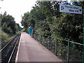
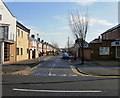
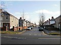
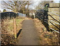

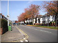


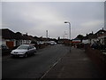
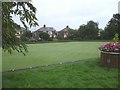

100 photos from this area
Area Information
Key information about the CF14 1RL including its size, population, and administrative classification.
- Area Type
- Postcode
- Area Size
- 9314 m²
- Population
- 1399
- Population Density
- 4781 people/km²
House Prices in CF14 1RL
20
Properties
£194,429
Average Sold Price
£84,000
Lowest Price
£340,000
Highest Price
Showing 20 properties
| Address | Type | Beds | Baths | Last Sale Price | Last Sale Date | |
|---|---|---|---|---|---|---|
| 84A Manor Way, Whitchurch, Cardiff, CF14 1RL | house | - | - | £340,000 | Feb 2022 | |
| 104 Manor Way, Whitchurch, Cardiff, CF14 1RL | Bungalow | - | - | £171,750 | Jan 2018 | |
| 90 Manor Way, Whitchurch, Cardiff, CF14 1RL | Semi-detached | 3 | 1 | £245,000 | Apr 2017 | |
| 92 Manor Way, Whitchurch, Cardiff, CF14 1RL | Semi-detached | 3 | 1 | £249,999 | Sep 2016 | |
| 106 Manor Way, Whitchurch, Cardiff, CF14 1RL | Bungalow | 2 | - | £210,000 | Jun 2016 | |
| 112 Manor Way, Whitchurch, Cardiff, CF14 1RL | house | - | - | £249,000 | Jun 2014 | |
| 84 Manor Way, Whitchurch, Cardiff, CF14 1RL | Semi-detached | - | - | £178,000 | Aug 2008 | |
| 96 Manor Way, Whitchurch, Cardiff, CF14 1RL | Semi-detached | - | - | £206,250 | Mar 2007 | |
| 98 Manor Way, Whitchurch, Cardiff, CF14 1RL | house | - | - | £177,000 | Nov 2004 | |
| 88 Manor Way, Whitchurch, Cardiff, CF14 1RL | Semi-detached | - | - | £179,000 | Aug 2004 |
Page 1 of 2
Energy Efficiency in CF14 1RL
Amenities
Schools
| Rank | School | Type | Entry gender | Ages |
|---|
Explore more schools in this area
Go to Schools tabDemographics
Household Size
Two person
most common
Accommodation Type
Houses
most common
Tenure
92
majority
Ethnic Group
White
most common
Religion
N/A
most common
Household Composition
N/A
most common
Age
47
median
Adults (30-64 years)
most common
Household Deprivation
N/A
with no deprivation
NS-SEC
48
in Lower managerial occupations
Explore more demographic insights in this area
Go to Demographics tabPlanning
Planning Constraints
- Flood RiskPremium
- Ramsar Wetland SitesPremium
- Area of Outstanding Natural BeautyPremium
- Protected Nature ReservePremium
- Protected WoodlandPremium
- Crime RiskPremium