Area Overview for CF14 1LZ
Photos of CF14 1LZ

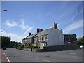
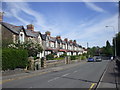
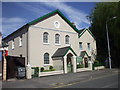
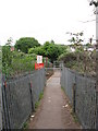
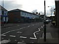
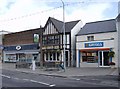
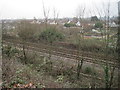

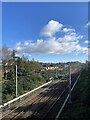

22 photos from this area
Area Information
Key information about the CF14 1LZ including its size, population, and administrative classification.
- Area Type
- Postcode
- Area Size
- 7392 m²
- Population
- 1631
- Population Density
- 4790 people/km²
House Prices in CF14 1LZ
12
Properties
£447,667
Average Sold Price
£165,000
Lowest Price
£750,000
Highest Price
Showing 12 properties
| Address | Type | Beds | Baths | Last Sale Price | Last Sale Date | |
|---|---|---|---|---|---|---|
| 8 Bishops Road, Whitchurch, Cardiff, CF14 1LZ | Semi-detached | 4 | 2 | £750,000 | Mar 2025 | |
| 22 Bishops Road, Whitchurch, Cardiff, CF14 1LZ | Semi-detached | 4 | 2 | £635,000 | Mar 2023 | |
| 10 Bishops Road, Whitchurch, Cardiff, CF14 1LZ | Semi-detached | 4 | 1 | £544,000 | Jul 2020 | |
| 6 Bishops Road, Whitchurch, Cardiff, CF14 1LZ | Detached | 4 | 1 | £510,000 | Mar 2019 | |
| 24 Bishops Road, Whitchurch, Cardiff, CF14 1LZ | house | - | - | £430,000 | Jan 2019 | |
| 26 Bishops Road, Whitchurch, Cardiff, CF14 1LZ | house | - | - | £495,000 | Sep 2014 | |
| 18 Bishops Road, Whitchurch, Cardiff, CF14 1LZ | Semi-detached | - | - | £330,000 | Jun 2006 | |
| 20 Bishops Road, Whitchurch, Cardiff, CF14 1LZ | Semi-detached | - | - | £165,000 | Dec 2000 | |
| 16 Bishops Road, Whitchurch, Cardiff, CF14 1LZ | Semi-detached | - | - | £170,000 | Dec 1997 | |
| 4 Bishops Road, Whitchurch, Cardiff, CF14 1LZ | Semi-detached | 4 | 1 | - | - |
Page 1 of 2
Energy Efficiency in CF14 1LZ
Amenities
Schools
| Rank | School | Type | Entry gender | Ages |
|---|
Explore more schools in this area
Go to Schools tabDemographics
Household Size
One person
most common
Accommodation Type
Houses
most common
Tenure
68
majority
Ethnic Group
White
most common
Religion
N/A
most common
Household Composition
N/A
most common
Age
47
median
Adults (30-64 years)
most common
Household Deprivation
N/A
with no deprivation
NS-SEC
44
in Lower managerial occupations
Explore more demographic insights in this area
Go to Demographics tabPlanning
Planning Constraints
- Flood RiskPremium
- Ramsar Wetland SitesPremium
- Area of Outstanding Natural BeautyPremium
- Protected Nature ReservePremium
- Protected WoodlandPremium
- Crime RiskPremium