Area Overview for CF14 0SN
Photos of CF14 0SN


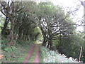
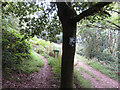
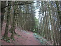
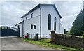

25 photos from this area
Area Information
Key information about the CF14 0SN including its size, population, and administrative classification.
- Area Type
- Postcode
- Area Size
- 2.3 km²
- Population
- 1756
- Population Density
- 518 people/km²
House Prices in CF14 0SN
49
Properties
£912,619
Average Sold Price
£139,900
Lowest Price
£3,150,000
Highest Price
Showing 49 properties
| Address | Type | Beds | Baths | Last Sale Price | Last Sale Date | |
|---|---|---|---|---|---|---|
| Hafod Y Bryn, Rudry Road, Lisvane, Cardiff, CF14 0SN | Retail | 3 | 2 | £625,000 | Apr 2022 | |
| Oakville Lodge, Rudry Road, Lisvane, CF14 0SN | house | 5 | - | £750,000 | Dec 2021 | |
| Amberly, Rudry Road, Lisvane, Cardiff, CF14 0SN | Detached | 4 | 3 | £600,000 | Jul 2020 | |
| 6 Rudry Road, Lisvane, Cardiff, CF14 0SN | Bungalow | 3 | 1 | £840,000 | Feb 2020 | |
| 3 Rudry Road, Lisvane, Cardiff, CF14 0SN | Detached | 4 | 2 | £565,000 | Oct 2017 | |
| Fairoak Farm, Rudry Road, Lisvane, Cardiff, CF14 0SN | house | - | - | £3,150,000 | May 2017 | |
| Llwyncelyn Bungalow, Rudry Road, Lisvane, CF14 0SN | Bungalow | - | - | £642,500 | Oct 2016 | |
| 2 Rudry Road, Lisvane, Cardiff, CF14 0SN | Semi-detached | 4 | - | £550,000 | May 2016 | |
| Erw Wen, Rudry Road, Lisvane, Cardiff, CF14 0SN | Detached | - | - | £3,150,000 | Jan 2014 | |
| 5 Rudry Road, Lisvane, Cardiff, CF14 0SN | house | - | - | £318,000 | Oct 2013 |
Page 1 of 5
Energy Efficiency in CF14 0SN
Amenities
Schools
| Rank | School | Type | Entry gender | Ages |
|---|
Explore more schools in this area
Go to Schools tabDemographics
Household Size
Family (3-5 people)
most common
Accommodation Type
Houses
most common
Tenure
88
majority
Ethnic Group
White
most common
Religion
N/A
most common
Household Composition
N/A
most common
Age
47
median
Adults (30-64 years)
most common
Household Deprivation
N/A
with no deprivation
NS-SEC
59
in Lower managerial occupations
Explore more demographic insights in this area
Go to Demographics tabPlanning
Planning Constraints
- Flood RiskPremium
- Ramsar Wetland SitesPremium
- Area of Outstanding Natural BeautyPremium
- Protected Nature ReservePremium
- Protected WoodlandPremium
- Crime RiskPremium