Area Overview for CF14 0SH
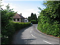
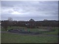
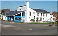
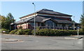
Photos of CF14 0SH


Area Information
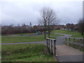
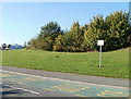
Living in CF14 0SH involves a daily experience defined by a small, tightly knit residential cluster situated within Wales. This specific postcode area covers 85.2 hectares and supports a population of 1,914, resulting in a population density of 1,517 people per square kilometre. The location forms part of a broader history of development, with the wider region of Pontprennau tracing roots back to farm origins before becoming a suburb through rapid housing expansion in the 1970s. The area reflects this deep history, with a new Bronze Age hoard discovered in a local field in 2021 underscoring the long-term human presence in the landscape. Today, the community is characterised by stability and established ownership patterns rather than transient renting habits. The physical scale is manageable, ensuring that residents often know their neighbours and the layout of their immediate surroundings. When you consider homes in CF14 0SH, you are looking at an environment where the quiet pace of a residential cluster meets the practical advantages of being close to Cardiff. The area does not boast vast open spaces on a parish scale but functions efficiently as a defined living zone. Its position allows easy access to vital services without the noise or density of the city centre itself. The character of the district is one of settled permanence, where decisions about buying or moving are made by homeowners who have put down roots over many years. This stability creates a predictable environment where local planning discussions and community decisions affect a relatively fixed group of residents.
- Area Type
- Postcode
- Area Size
- 85.2 hectares
- Population
- 1914
- Population Density
- 1517 people/km²
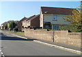
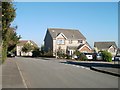
The property market in CF14 0SH is defined by established ownership and traditional housing stock. With a home ownership rate of 78 per cent, this postcode operates as a primary market for buyers looking to own rather than a secondary market dominated by private landlords. Because the area consists mainly of houses, you will encounter detached, semi-detached, or terraced properties rather than the high-density blocks typical of city centre living. This concentration of owned homes suggests that many residents have purchased in previous years and are now selling as they change life stages. When you search for homes in CF14 0SH, the market will reflect a slower pace than new-build dispersals. The 78 per cent ownership figure means most transactions involve keyholders who know their property fit-outs intimately. This stability often results in carefully maintained properties, though individual standards will vary based on the owner's personal investment. The mix of house types offers flexibility for buyers seeking gardens or backyards, which are assets of high value to the majority of residents. The market is less volatile than areas with high leasehold flats, as the dominant tenure structure relies on freehold or long leasehold arrangements typical of suburban housing.
House Prices in CF14 0SH
Showing 47 properties
| Address | Type | Beds | Baths | Last Sale Price | Last Sale Date | |
|---|---|---|---|---|---|---|
| Broomfield, St Mellons Road, Lisvane, Cardiff, CF14 0SH | Detached | 4 | 2 | £595,000 | May 2025 | |
| Malthouse Cottage, St Mellons Road, Pontprennau, Cardiff, CF14 0SH | house | - | - | £480,000 | May 2024 | |
| Wood Norton, Maerdy Lane, Lisvane, Cardiff, CF14 0SH | Detached | 3 | - | £430,000 | Mar 2014 | |
| Avondale, St Mellons Road, Lisvane, Cardiff, CF14 0SH | house | - | - | £300,000 | May 2013 | |
| Glandwr, St Mellons Road, Lisvane, Cardiff, CF14 0SH | Semi-detached | - | - | £306,000 | May 2007 | |
| Crossways, St Mellons Road, Lisvane, Cardiff, CF14 0SH | house | - | - | £250,000 | Apr 2006 | |
| Woodcote, St Mellons Road, Lisvane, Cardiff, CF14 0SH | Detached | - | - | £180,000 | Jun 2001 | |
| West Hill, St Mellons Road, Lisvane, Cardiff, CF14 0SH | house | - | - | £185,000 | Jul 1999 | |
| Nant Y Draenog, St Mellons Road, Pontprennau, Cardiff, CF14 0SH | Detached | - | - | £45,000 | Mar 1997 | |
| Ty Felyn, St Mellons Road, Lisvane, Cardiff, CF14 0SH | Detached | 6 | 3 | - | - |
Energy Efficiency in CF14 0SH
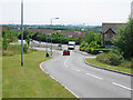
Daily life in CF14 0SH centres on convenient access to essential services and leisure facilities that are within practical reach. You can find five major retail outlets nearby, providing a solid selection for weekly shopping at Aldi Pentwyn, Waitrose Pontprennau, and Lidl Pentwyn. These supermarkets are sufficient for all household needs without requiring lengthy drives. Leisure and dining options extend slightly further into the wider suburb of Pontprennau, which was originally a farm before becoming a residential estate in the 1970s. The area's history is layered, with a Bronze Age hoard recently discovered in a local field, reminding residents of the deep time beneath their gardens. Transport infrastructure supports an active lifestyle with five railway stations conveniently located nearby, including Llanishen Railway Station, Lisvane & Thornhill Railway Station, and Heath High Level Railway Station. The Taffs Mead Waterbus Stop and Clarence Embankment Waterbus Stop offer unique river commuter options if you prefer a different route into the city. A single main bus hub at the Cardiff Bus Interchange covers the wider network for destinations not served by rail. This variety of transport modes gives you the flexibility to choose your journey based on the time of day or your personal preference. The local economy is also stimulated by proximity to the M4 motorway, which aids commercial travel and logistics in the surrounding east Cardiff region.
Amenities
Schools
| Rank | School | Type | Entry gender | Ages |
|---|
Explore more schools in this area
Go to Schools tabDemographics
The community within CF14 0SH demonstrates a clear demographic profile that skews significantly towards established adulthood. The median age stands at 47 years, indicating that the local population is mid-life rather than young families or retirees. The most common age range comprises adults between 30 and 64 years, which suggests a workforce that has moved past the initial career launch phase and has children at home or is rearing independent adults. You will find that the area is predominantly populated by white people, with this group forming the vast majority of the ethnic mix. Home ownership is the dominant housing tenure in this postcode, with a figure of 78 per cent of residents owning their properties outright or with a mortgage. This high rate of ownership typically signals a community with deep local knowledge and long-term residents rather than a transient renting population. The accommodation type is overwhelmingly houses, offering distinct residential spaces away from the higher density found in urban flats. This housing stock complements the age profile, providing the space and gardens often required by families and professionals in their middle years. There is no significant data provided regarding deprivation levels, but the high ownership and specific age distribution paint a picture of a self-sustaining, stable neighbourhood.
Household Size
Accommodation Type
Tenure
Ethnic Group
Religion
Household Composition
Age
Household Deprivation
NS-SEC
Explore more demographic insights in this area
Go to Demographics tabPlanning
Planning Constraints
- Flood RiskPremium
- Ramsar Wetland SitesPremium
- Area of Outstanding Natural BeautyPremium
- Protected Nature ReservePremium
- Protected WoodlandPremium
- Crime RiskPremium