Area Overview for CF11 9XH
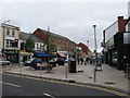
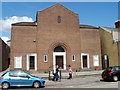
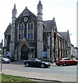
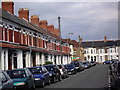
Photos of CF11 9XH

Area Information
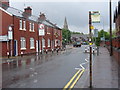
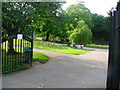
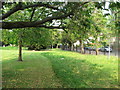
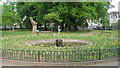
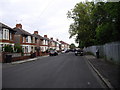
CF11 9XH, a small postcode area in the west of Cardiff, Wales, is a quiet residential cluster with a population of 1658. Situated in Pontcanna, it lies between Western Avenue, the River Taff, and Llandaff Road, just beyond the city centre. The area’s name traces back to ‘Pont Canna Farm’, referencing a bridge over the Whitehouse Brook. Today, it is a leafy, affluent suburb known for wide tree-lined streets, large Victorian villas, and elegant terraced homes. The community thrives on a mix of English-born residents (around 25%) and Welsh speakers (about 20%), creating a culturally diverse yet cohesive atmosphere. Local landmarks include Sophia Gardens, a historic park once central to the area’s development, and Bute Park, offering green space for leisure. Proximity to the city centre, combined with a relaxed, suburban feel, makes CF11 9XH appealing for those seeking a balance between urban convenience and residential tranquillity.
- Area Type
- Postcode
- Area Size
- Not available
- Population
- 1658
- Population Density
- 9221 people/km²
CF11 9XH is primarily an owner-occupied area, with 61% of properties in private hands. The accommodation type is predominantly houses, reflecting the area’s historic development as a district of large Victorian villas and elegant terraced homes. This contrasts with more densely populated urban areas, where flats are common. The limited size of the postcode area means the housing stock is relatively small, with fewer new builds or rental properties. For buyers, this implies a market focused on established properties with character, often located on tree-lined streets or near green spaces like Sophia Gardens. The scarcity of available homes may make the area competitive for buyers seeking larger, traditional properties. However, the lack of high-density housing also means fewer options for those prioritising modern or rental properties.
House Prices in CF11 9XH
No properties found in this postcode.
Energy Efficiency in CF11 9XH
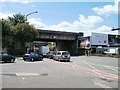
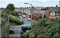
Living in CF11 9XH offers access to a range of amenities within practical reach. Retail options include major chains like Tesco Canton, Iceland Canton, and Co-op Canton, ensuring everyday shopping needs are met. The area’s character is enhanced by its proximity to parks such as Sophia Gardens, Llandaff Fields, and Bute Park, which provide green space for recreation and relaxation. Cafés and independent retailers line Pontcanna Street and Cathedral Road, contributing to a vibrant, localised shopping and dining scene. The presence of ferry stops and multiple railway stations adds to the area’s convenience, linking residents to Cardiff’s cultural and commercial hubs. This blend of natural beauty, retail, and transport options creates a lifestyle that balances suburban tranquillity with urban accessibility.
Amenities
Schools
The nearest school to CF11 9XH is St Mary’s R.C. Primary School, which serves the local community. While the data does not include Ofsted ratings or specific academic performance metrics, the presence of a primary school indicates that families with young children have access to local education. The absence of secondary schools or additional educational institutions in the immediate vicinity may require families to consider commuting to nearby areas for secondary education. However, the proximity to Cardiff’s city centre and major transport links could ease such commutes. The mix of school types is limited to primary education here, suggesting that parents may need to look beyond the immediate area for comprehensive schooling options.
| Rank | School | Type | Entry gender | Ages |
|---|
Explore more schools in this area
Go to Schools tabDemographics
The median age in CF11 9XH is 47, with the majority of residents falling within the 30-64 age range. This suggests a mature, stable community with a strong presence of middle-aged and older adults. Home ownership is high at 61%, reflecting a predominance of owner-occupied properties. The area is characterised by houses rather than flats, indicating larger, more traditional housing stock. The predominant ethnic group is White, though the data does not specify further diversity metrics. The absence of detailed deprivation data means no conclusions can be drawn about economic hardship, but the high home ownership rate and age profile imply a relatively secure, low-turnover population. This demographic profile aligns with Pontcanna’s reputation as a wealthy, suburban area with a focus on established, long-term residents.
Household Size
Accommodation Type
Tenure
Ethnic Group
Religion
Household Composition
Age
Household Deprivation
NS-SEC
Explore more demographic insights in this area
Go to Demographics tabPlanning
Planning Constraints
- Flood RiskPremium
- Ramsar Wetland SitesPremium
- Area of Outstanding Natural BeautyPremium
- Protected Nature ReservePremium
- Protected WoodlandPremium
- Crime RiskPremium