Area Overview for CF11 8PD
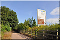
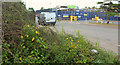
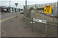
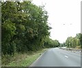
Photos of CF11 8PD


Area Information
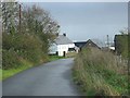
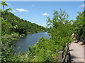
CF11 8PD is a small, densely populated residential cluster in Cardiff, Wales, covering just 3,932 square metres. With 1,591 residents, it is a compact area where daily life is shaped by its proximity to the city’s historic core and modern infrastructure. Originally marshy farmland linked to Margam Abbey in the 12th century, the area transformed into a residential suburb by the 19th century, connected by Penarth Road and bridges. Today, it is a well-served neighbourhood with easy access to retail, transport, and schools. The high population density of 1,171 people per square kilometre reflects its role as a hub for families and commuters. Living here means navigating a tight-knit community with a mix of historic and modern housing, all within walking distance of major amenities. Its location between the River Taff and River Ely offers a blend of urban convenience and historical character, making it a practical choice for those seeking a balance between city life and manageable living space.
- Area Type
- Postcode
- Area Size
- 3932 m²
- Population
- 1591
- Population Density
- 1171 people/km²
The property market in CF11 8PD is characterised by a high rate of home ownership—65% of residents own their homes—indicating a stable, long-term community rather than a transient rental market. The area is predominantly composed of houses, not flats, which aligns with its family-oriented profile. This suggests a focus on traditional, spacious properties rather than high-density housing. Given the small size of the postcode area, buyers should consider nearby suburbs for additional options. The prevalence of owner-occupied homes may mean limited availability of rental properties, though this could also contribute to a sense of security for homeowners. The compact nature of the area means that property values are likely influenced by proximity to key amenities such as schools, transport links, and retail hubs. For buyers, this presents a mix of established housing stock and the potential for long-term investment in a well-connected, family-friendly environment.
House Prices in CF11 8PD
No properties found in this postcode.
Energy Efficiency in CF11 8PD
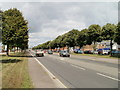
Residents of CF11 8PD enjoy a range of nearby amenities that cater to daily needs and leisure. Retail options include Costco Cardiff, Asda Leckwith, and Tesco Grangetown, providing access to large supermarkets and big-name brands. The area’s rail network connects to Grangetown, Ninian Park, and Cardiff Central stations, while waterbus stops at Channel View, Taffs Mead, and Clarence Embankment offer scenic routes along the River Taff. The Cardiff Bus Interchange, though only one stop is listed, serves as a gateway to broader transport networks. For dining and shopping, the proximity to major retail parks and supermarkets suggests a practical, convenience-focused lifestyle. The mix of transport options and retail hubs ensures residents can meet both essential and recreational needs without long commutes. The compact nature of the area means amenities are tightly clustered, enhancing accessibility for families and commuters alike.
Amenities
Schools
Residents of CF11 8PD have access to two primary schools: Ninian Park Primary School and Ysgol Newydd - Ninian Park Primary School. Both are listed as "other" in the data, though specific Ofsted ratings are not provided. The presence of two primary schools within the area suggests a focus on early education, which is critical for families with young children. The dual names may indicate a shared campus or phased development, but without further details, this remains speculative. For families, the availability of two schools reduces competition for places and offers flexibility in choosing between institutions. However, the absence of secondary school data means parents may need to look beyond the immediate postcode for comprehensive education. The proximity of these schools to residential areas underscores the area’s suitability for families prioritising accessible schooling.
| Rank | School | Type | Entry gender | Ages |
|---|
Explore more schools in this area
Go to Schools tabDemographics
The population of CF11 8PD skews towards adults aged 30–64, with a median age of 47. This suggests a community of established professionals and families, rather than a younger or retired demographic. Home ownership is strong, with 65% of residents owning their homes, compared to 35% renting. The area is predominantly composed of houses, not flats, reflecting a preference for traditional family housing. The predominant ethnic group is White, though specific diversity metrics are not provided. The high population density—1,171 people per square kilometre—indicates a compact, possibly multi-generational living environment. While this density can mean limited private space, it also fosters a sense of community. The absence of specific deprivation data means it is unclear how this compares to broader Welsh averages, but the mix of home ownership and family-oriented housing suggests a stable, middle-income demographic.
Household Size
Accommodation Type
Tenure
Ethnic Group
Religion
Household Composition
Age
Household Deprivation
NS-SEC
Explore more demographic insights in this area
Go to Demographics tabPlanning
Planning Constraints
- Flood RiskPremium
- Ramsar Wetland SitesPremium
- Area of Outstanding Natural BeautyPremium
- Protected Nature ReservePremium
- Protected WoodlandPremium
- Crime RiskPremium