Area Overview for CF11 7XS
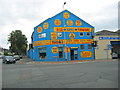
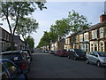
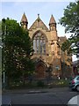
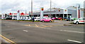
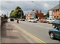
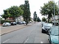
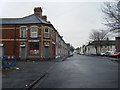
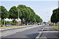
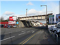
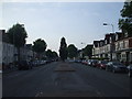
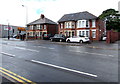
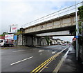
Photos of CF11 7XS
Area Information
CF11 7XS is a compact residential postcode in Cardiff, Wales, encompassing a small cluster of homes within 2,871 square metres. With a population of 1,778 people, the area has a remarkably high population density of 619,394 people per square kilometre, reflecting its tight-knit, urban character. Situated between the River Taff and River Ely, the area has a long history as a former monastic grange, evolving into a residential suburb by the late 19th century. Today, it blends historical roots with modern living, offering a mix of older homes and community-focused amenities. The area’s proximity to Cardiff’s city centre, combined with its transport links and schools, makes it appealing for families and commuters. Its compact size means residents are close to key services, though the high density underscores the need for efficient local infrastructure. For those seeking a small, connected community with a rich historical backdrop, CF11 7XS presents a distinctive blend of residential life and urban convenience.
- Area Type
- Postcode
- Area Size
- 2871 m²
- Population
- 1778
- Population Density
- 11464 people/km²
The property market in CF11 7XS is characterised by a 50% home ownership rate, indicating a mix of owner-occupied and rental properties. The area is dominated by houses, which are the primary accommodation type, suggesting a focus on family homes and standalone living. Given the small size of the postcode, the housing stock is likely limited in volume, making it a niche market for buyers seeking specific properties. The presence of houses may appeal to those prioritising space and privacy, though the high population density implies proximity to neighbours. For buyers, the area’s compact nature means that properties are likely to be in close proximity to amenities and transport links, which could be a significant advantage. However, the limited size of the area may also mean fewer options for those seeking larger or newer homes.
House Prices in CF11 7XS
No properties found in this postcode.
Energy Efficiency in CF11 7XS
Daily life in CF11 7XS is supported by a range of nearby amenities, from retail to transport hubs. The area’s retail options include major supermarkets such as Tesco Grangetown, Lidl Cardiff, and Iceland Cardiff, ensuring easy access to groceries and household essentials. For leisure and travel, five ferry stops—Channel View, Clarence Embankment, and Taffs Mead Waterbus Stops—provide connections to Cardiff’s waterways. Rail services are well-represented, with Grangetown Railway Station, Cardiff Central, and Cardiff Bay stations offering links to the wider region. The Cardiff Bus Interchange is also nearby, enhancing mobility. These amenities contribute to a convenient, connected lifestyle, where residents can access shopping, transport, and recreational opportunities without long commutes. The compact layout of the area means that these services are within practical reach, fostering a sense of accessibility and community.
Amenities
Schools
Residents of CF11 7XS have access to three primary schools within the vicinity: Grangetown Junior School, Grangetown Infants School, and Grange Town Primary. These institutions cater to early and primary education, though specific Ofsted ratings are not provided in the data. The presence of multiple schools suggests a focus on local education, potentially offering families a range of options for their children’s schooling. The schools’ proximity to homes in the area reinforces the suburb’s appeal for families seeking convenient access to educational facilities. While no data on secondary schools is available, the availability of primary schools alone may influence decisions for homebuyers prioritising family-friendly environments.
| Rank | School | Type | Entry gender | Ages |
|---|
Explore more schools in this area
Go to Schools tabDemographics
The population of CF11 7XS is predominantly adults aged 30–64, with a median age of 47. This suggests a mature, stable community with a focus on family living and long-term residency. Home ownership in the area stands at 50%, indicating a balance between owner-occupied properties and rental homes. The accommodation type is primarily houses, reflecting a preference for standalone homes rather than flats or apartments. The predominant ethnic group is White, with no specific data on other demographics provided. The high population density of 619,394 people per square kilometre implies a tightly packed residential layout, which may influence local amenities and public services. While the data does not include deprivation metrics, the age profile and home ownership rate suggest a community that is largely self-sufficient, with a focus on established households rather than transient populations.
Household Size
Accommodation Type
Tenure
Ethnic Group
Religion
Household Composition
Age
Household Deprivation
NS-SEC
Explore more demographic insights in this area
Go to Demographics tabPlanning
Planning Constraints
- Flood RiskPremium
- Ramsar Wetland SitesPremium
- Area of Outstanding Natural BeautyPremium
- Protected Nature ReservePremium
- Protected WoodlandPremium
- Crime RiskPremium