Area Overview for CF11 6WE
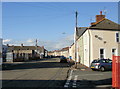
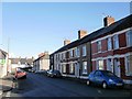
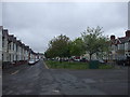
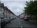
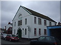
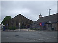
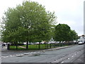
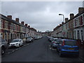
Photos of CF11 6WE


Area Information
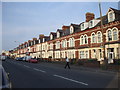
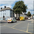
CF11 6WE, part of the Grangetown area in Cardiff, Wales, is a small residential postcode cluster with a population of 2015. Situated between the River Taff to the east and the River Ely to the west, it is a historic suburb that evolved from 12th-century monastic grange land into a residential community after 1850. The area’s character blends its medieval roots with modern infrastructure, including housing developments linked to Penarth Road and bridges connecting Cardiff to Penarth. With a median age of 22, it is a young adult-dominated area, reflecting its appeal to students and early professionals. Daily life here is shaped by proximity to transport hubs, retail, and waterbus services, while the low flood risk and lack of environmental constraints make it a practical choice for buyers seeking a compact, accessible neighbourhood. Its compact size means amenities are within practical reach, and its history as a former industrial area now supports a mix of residential and commuter-focused living.
- Area Type
- Postcode
- Area Size
- Not available
- Population
- 2015
- Population Density
- 7964 people/km²
The property market in CF11 6WE is characterised by a 46% home ownership rate, with houses being the predominant accommodation type. This suggests a mix of owner-occupied homes and rental properties, though the exact balance between the two is not specified. Given the area’s small size and residential focus, property availability is likely limited, and buyers may need to consider nearby areas for more options. The presence of houses rather than flats or apartments indicates a preference for family-friendly or semi-detached living, which may appeal to young professionals or couples starting families. However, the relatively low home ownership rate (compared to national averages) suggests a significant rental market, potentially driven by students or workers commuting to Cardiff’s city centre. For buyers, this means competition may be fierce, and properties could be priced in line with broader Cardiff trends.
House Prices in CF11 6WE
No properties found in this postcode.
Energy Efficiency in CF11 6WE
Living in CF11 6WE offers access to a range of amenities within practical reach. Retail options include major stores such as Tesco Grangetown, Tesco Cardiff, and Sainsburys Cardiff, ensuring daily shopping needs are met. The area’s transport network includes five ferry stops and five rail stations, including Cardiff Central, which connects to the wider city and regional routes. For leisure, the nearby Grange National School, established in 1864, serves the community, and historical sites like The Grange, an 800-year-old building, add cultural depth. The proximity to waterbus stops also provides easy access to Cardiff’s waterfront and attractions. While the area lacks large parks, its compact layout means residents can reach green spaces or recreational facilities in nearby parts of Cardiff. This mix of retail, transport, and historical features creates a convenient, accessible lifestyle for residents.
Amenities
Schools
| Rank | School | Type | Entry gender | Ages |
|---|
Explore more schools in this area
Go to Schools tabDemographics
CF11 6WE has a median age of 22, with the most common age range being 15–29 years. This reflects a community dominated by young adults, likely students or early-career professionals. Home ownership in the area stands at 46%, indicating that nearly half of residents rent their homes, while the other 54% are likely to be private renters or live in other tenancy arrangements. The predominant accommodation type is houses, suggesting a mix of family homes and single-occupancy properties. The area’s population is predominantly White, though specific diversity statistics are not provided. The young age profile and high proportion of renters imply a dynamic, transient community, which may influence local services and amenities. The absence of detailed deprivation data means quality of life factors such as access to education or healthcare are not explicitly quantified here, but the area’s proximity to schools and transport suggests these needs are met.
Household Size
Accommodation Type
Tenure
Ethnic Group
Religion
Household Composition
Age
Household Deprivation
NS-SEC
Explore more demographic insights in this area
Go to Demographics tabPlanning
Planning Constraints
- Flood RiskPremium
- Ramsar Wetland SitesPremium
- Area of Outstanding Natural BeautyPremium
- Protected Nature ReservePremium
- Protected WoodlandPremium
- Crime RiskPremium