Area Overview for CF11 6TD
Photos of CF11 6TD

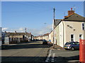
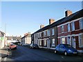
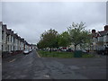
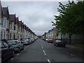
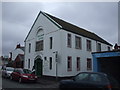
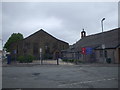
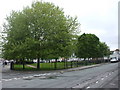
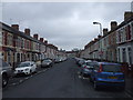
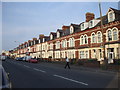

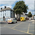
100 photos from this area
Area Information
Key information about the CF11 6TD including its size, population, and administrative classification.
- Area Type
- Postcode
- Area Size
- 1.1 hectares
- Population
- 1690
- Population Density
- 13318 people/km²
House Prices in CF11 6TD
61
Properties
£146,493
Average Sold Price
£40,000
Lowest Price
£255,000
Highest Price
Showing 61 properties
| Address | Type | Beds | Baths | Last Sale Price | Last Sale Date | |
|---|---|---|---|---|---|---|
| 45 Rutland Street, Grangetown, Cardiff, CF11 6TD | Terraced | 2 | 1 | £250,000 | Feb 2025 | |
| 39 Rutland Street, Grangetown, Cardiff, CF11 6TD | Terraced | 2 | - | £255,000 | Jan 2025 | |
| 41 Rutland Street, Grangetown, Cardiff, CF11 6TD | Terraced | 2 | 1 | £240,000 | Jan 2023 | |
| 6 Rutland Street, Grangetown, Cardiff, CF11 6TD | house | - | - | £235,000 | Nov 2021 | |
| 43 Rutland Street, Grangetown, Cardiff, CF11 6TD | house | - | - | £192,500 | Apr 2021 | |
| 15 Rutland Street, Grangetown, Cardiff, CF11 6TD | Terraced | 3 | 1 | £185,000 | Apr 2020 | |
| 10 Rutland Street, Grangetown, Cardiff, CF11 6TD | Terraced | 2 | 1 | £173,000 | Sep 2019 | |
| 23 Rutland Street, Grangetown, Cardiff, CF11 6TD | Terraced | 2 | 2 | £150,000 | Dec 2018 | |
| 12 Rutland Street, Grangetown, Cardiff, CF11 6TD | house | 3 | - | £155,000 | Oct 2016 | |
| 47 Rutland Street, Grangetown, Cardiff, CF11 6TD | Terraced | 3 | - | £135,000 | May 2014 |
Page 1 of 7
Energy Efficiency in CF11 6TD
Amenities
Schools
| Rank | School | Type | Entry gender | Ages |
|---|
Explore more schools in this area
Go to Schools tabDemographics
Household Size
One person
most common
Accommodation Type
Houses
most common
Tenure
50
majority
Ethnic Group
White
most common
Religion
N/A
most common
Household Composition
N/A
most common
Age
47
median
Adults (30-64 years)
most common
Household Deprivation
N/A
with no deprivation
NS-SEC
26
in Lower managerial occupations
Explore more demographic insights in this area
Go to Demographics tabPlanning
Planning Constraints
- Flood RiskPremium
- Ramsar Wetland SitesPremium
- Area of Outstanding Natural BeautyPremium
- Protected Nature ReservePremium
- Protected WoodlandPremium
- Crime RiskPremium