Area Overview for CF11 6RA
Photos of CF11 6RA

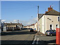
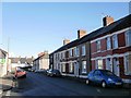
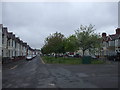
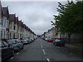


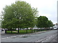
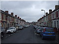
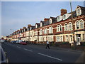

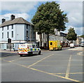
100 photos from this area
Area Information
Key information about the CF11 6RA including its size, population, and administrative classification.
- Area Type
- Postcode
- Area Size
- 4024 m²
- Population
- 2015
- Population Density
- 7964 people/km²
House Prices in CF11 6RA
19
Properties
£226,229
Average Sold Price
£37,250
Lowest Price
£348,000
Highest Price
Showing 19 properties
| Address | Type | Beds | Baths | Last Sale Price | Last Sale Date | |
|---|---|---|---|---|---|---|
| 8 Hafod Street, Grangetown, Cardiff, CF11 6RA | Terraced | 3 | 1 | £250,000 | Jul 2024 | |
| 3 Hafod Street, Grangetown, Cardiff, CF11 6RA | Terraced | 3 | 1 | £340,000 | Jun 2024 | |
| 11 Hafod Street, Grangetown, Cardiff, CF11 6RA | Terraced | 3 | 1 | £348,000 | Dec 2023 | |
| 15 Hafod Street, Grangetown, Cardiff, CF11 6RA | house | - | - | £240,000 | Sep 2023 | |
| 17 Hafod Street, Grangetown, Cardiff, CF11 6RA | house | - | - | £300,000 | Nov 2022 | |
| 14 Hafod Street, Grangetown, Cardiff, CF11 6RA | house | 3 | 1 | £320,000 | Oct 2021 | |
| 4 Hafod Street, Grangetown, Cardiff, CF11 6RA | Terraced | 3 | 1 | £266,000 | Jul 2018 | |
| 16 Hafod Street, Grangetown, Cardiff, CF11 6RA | house | - | - | £217,000 | Aug 2013 | |
| 6 Hafod Street, Grangetown, Cardiff, CF11 6RA | house | - | - | £196,500 | Jun 2008 | |
| 7 Hafod Street, Grangetown, Cardiff, CF11 6RA | house | - | - | £150,000 | Jan 2004 |
Page 1 of 2
Energy Efficiency in CF11 6RA
Amenities
Schools
| Rank | School | Type | Entry gender | Ages |
|---|
Explore more schools in this area
Go to Schools tabDemographics
Household Size
Family (3-5 people)
most common
Accommodation Type
Houses
most common
Tenure
46
majority
Ethnic Group
White
most common
Religion
N/A
most common
Household Composition
N/A
most common
Age
22
median
Young Adults (15-29 years)
most common
Household Deprivation
N/A
with no deprivation
NS-SEC
17
in Lower managerial occupations
Explore more demographic insights in this area
Go to Demographics tabPlanning
Planning Constraints
- Flood RiskPremium
- Ramsar Wetland SitesPremium
- Area of Outstanding Natural BeautyPremium
- Protected Nature ReservePremium
- Protected WoodlandPremium
- Crime RiskPremium