Area Overview for CF11 6QP
Photos of CF11 6QP

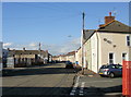
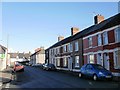
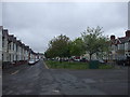
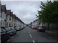
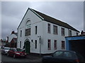
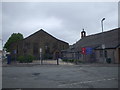
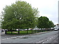
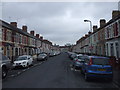
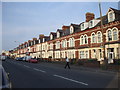
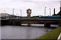
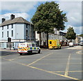
100 photos from this area
Area Information
Key information about the CF11 6QP including its size, population, and administrative classification.
- Area Type
- Postcode
- Area Size
- 5516 m²
- Population
- 1690
- Population Density
- 13318 people/km²
House Prices in CF11 6QP
44
Properties
£148,333
Average Sold Price
£46,000
Lowest Price
£310,000
Highest Price
Showing 44 properties
| Address | Type | Beds | Baths | Last Sale Price | Last Sale Date | |
|---|---|---|---|---|---|---|
| 41 Clare Road, Grangetown, Cardiff, CF11 6QP | Terraced | 3 | 2 | £310,000 | Sep 2025 | |
| 23 Clare Road, Grangetown, Cardiff, CF11 6QP | Terraced | 2 | 1 | £109,000 | May 2013 | |
| 21 Clare Road, Grangetown, Cardiff, CF11 6QP | house | 4 | 1 | £106,000 | Oct 2012 | |
| 39 Clare Road, Grangetown, Cardiff, CF11 6QP | Terraced | - | - | £175,000 | Aug 2007 | |
| 55 Clare Road, Grangetown, Cardiff, CF11 6QP | Terraced | 3 | 1 | £144,000 | Dec 2006 | |
| 53 Clare Road, Grangetown, Cardiff, CF11 6QP | house | - | - | £46,000 | Jul 1999 | |
| 63A Clare Road, Grangetown, Cardiff, CF11 6QP | Terraced | 3 | - | - | - | |
| Proposed Flats 7, Proposed Development, 27-35 Clare Road, Grangetown, Cardiff, CF11 6QP | Flat | - | - | - | - | |
| Proposed Flats 9, Proposed Development, 27-35 Clare Road, Grangetown, Cardiff, CF11 6QP | Flat | - | - | - | - | |
| Proposed Flats 4, Proposed Development, 27-35 Clare Road, Grangetown, Cardiff, CF11 6QP | Flat | - | - | - | - |
Page 1 of 5
Energy Efficiency in CF11 6QP
Amenities
Schools
| Rank | School | Type | Entry gender | Ages |
|---|
Explore more schools in this area
Go to Schools tabDemographics
Household Size
One person
most common
Accommodation Type
Houses
most common
Tenure
50
majority
Ethnic Group
White
most common
Religion
N/A
most common
Household Composition
N/A
most common
Age
47
median
Adults (30-64 years)
most common
Household Deprivation
N/A
with no deprivation
NS-SEC
26
in Lower managerial occupations
Explore more demographic insights in this area
Go to Demographics tabPlanning
Planning Constraints
- Flood RiskPremium
- Ramsar Wetland SitesPremium
- Area of Outstanding Natural BeautyPremium
- Protected Nature ReservePremium
- Protected WoodlandPremium
- Crime RiskPremium