Area Overview for CF11 0AP
Photos of CF11 0AP


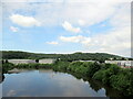
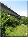
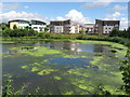
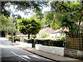
46 photos from this area
Area Information
Key information about the CF11 0AP including its size, population, and administrative classification.
- Area Type
- Postcode
- Area Size
- 1.2 hectares
- Population
- 1732
- Population Density
- 1410 people/km²
House Prices in CF11 0AP
64
Properties
£182,438
Average Sold Price
£65,730
Lowest Price
£880,000
Highest Price
Showing 64 properties
| Address | Type | Beds | Baths | Last Sale Price | Last Sale Date | |
|---|---|---|---|---|---|---|
| 49 Burford Gardens, Grangetown, Cardiff, CF11 0AP | Terraced | 3 | 2 | £325,000 | Oct 2025 | |
| 33 Burford Gardens, Grangetown, Cardiff, CF11 0AP | Flat | 2 | 2 | £165,000 | Jul 2025 | |
| 59 Burford Gardens, Grangetown, Cardiff, CF11 0AP | house | - | - | £325,000 | Mar 2025 | |
| 45 Burford Gardens, Grangetown, Cardiff, CF11 0AP | Flat | 2 | 1 | £170,000 | Jun 2024 | |
| 67 Burford Gardens, Grangetown, Cardiff, CF11 0AP | Flat | - | - | £167,500 | Jun 2024 | |
| 24 Burford Gardens, Grangetown, Cardiff, CF11 0AP | Semi-detached | 4 | 2 | £350,000 | Feb 2024 | |
| 7 Burford Gardens, Grangetown, Cardiff, CF11 0AP | Flat | 2 | 1 | £157,000 | Jan 2024 | |
| 16 Burford Gardens, Grangetown, Cardiff, CF11 0AP | house | - | - | £323,000 | Nov 2023 | |
| 31 Burford Gardens, Grangetown, Cardiff, CF11 0AP | Flat | 2 | 2 | £177,500 | Oct 2022 | |
| 38 Burford Gardens, Grangetown, Cardiff, CF11 0AP | Flat | - | - | £194,000 | Jul 2022 |
Page 1 of 7
Energy Efficiency in CF11 0AP
Amenities
Schools
| Rank | School | Type | Entry gender | Ages |
|---|
Explore more schools in this area
Go to Schools tabDemographics
Household Size
One person
most common
Accommodation Type
Flats
most common
Tenure
38
majority
Ethnic Group
White
most common
Religion
N/A
most common
Household Composition
N/A
most common
Age
47
median
Adults (30-64 years)
most common
Household Deprivation
N/A
with no deprivation
NS-SEC
52
in Lower managerial occupations
Explore more demographic insights in this area
Go to Demographics tabPlanning
Planning Constraints
- Flood RiskPremium
- Ramsar Wetland SitesPremium
- Area of Outstanding Natural BeautyPremium
- Protected Nature ReservePremium
- Protected WoodlandPremium
- Crime RiskPremium