Area Overview for CF10 5NF
Photos of CF10 5NF

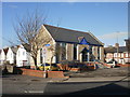
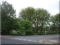

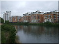


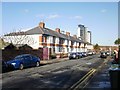

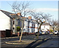
100 photos from this area
Area Information
Key information about the CF10 5NF including its size, population, and administrative classification.
- Area Type
- Postcode
- Area Size
- 6237 m²
- Population
- 1172
- Population Density
- 14724 people/km²
House Prices in CF10 5NF
62
Properties
£183,683
Average Sold Price
£120,000
Lowest Price
£275,000
Highest Price
Showing 62 properties
| Address | Type | Beds | Baths | Last Sale Price | Last Sale Date | |
|---|---|---|---|---|---|---|
| 13, Lynton Court, Chandlery Way, Butetown, Cardiff, CF10 5NF | Flat | - | - | £235,000 | Dec 2024 | |
| 40, Lynton Court, Chandlery Way, Butetown, Cardiff, CF10 5NF | Flat | - | - | £157,500 | Nov 2024 | |
| 37, Lynton Court, Chandlery Way, Butetown, Cardiff, CF10 5NF | Flat | - | - | £230,000 | Sep 2024 | |
| 14, Lynton Court, Chandlery Way, Butetown, Cardiff, CF10 5NF | Flat | - | - | £275,000 | Jul 2024 | |
| 3, Lynton Court, Chandlery Way, Butetown, Cardiff, CF10 5NF | Flat | - | - | £180,000 | Apr 2024 | |
| 36, Lynton Court, Chandlery Way, Butetown, Cardiff, CF10 5NF | Flat | - | - | £176,000 | Mar 2024 | |
| 18, Lynton Court, Chandlery Way, Butetown, Cardiff, CF10 5NF | Flat | - | - | £166,000 | Feb 2024 | |
| 39, Lynton Court, Chandlery Way, Butetown, Cardiff, CF10 5NF | Flat | - | - | £145,000 | Jan 2024 | |
| 61, Lynton Court, Chandlery Way, Butetown, Cardiff, CF10 5NF | Flat | - | - | £235,000 | Jun 2023 | |
| 28, Lynton Court, Chandlery Way, Butetown, Cardiff, CF10 5NF | Flat | - | - | £190,000 | Jun 2023 |
Page 1 of 7
Energy Efficiency in CF10 5NF
Amenities
Schools
| Rank | School | Type | Entry gender | Ages |
|---|
Explore more schools in this area
Go to Schools tabDemographics
Household Size
Two person
most common
Accommodation Type
Flats
most common
Tenure
44
majority
Ethnic Group
White
most common
Religion
N/A
most common
Household Composition
N/A
most common
Age
47
median
Adults (30-64 years)
most common
Household Deprivation
N/A
with no deprivation
NS-SEC
53
in Lower managerial occupations
Explore more demographic insights in this area
Go to Demographics tabPlanning
Planning Constraints
- Flood RiskPremium
- Ramsar Wetland SitesPremium
- Area of Outstanding Natural BeautyPremium
- Protected Nature ReservePremium
- Protected WoodlandPremium
- Crime RiskPremium