Area Overview for CF10 5FS
Photos of CF10 5FS
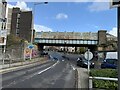

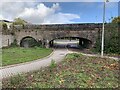
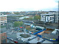


100 photos from this area
Area Information
Key information about the CF10 5FS including its size, population, and administrative classification.
- Area Type
- Postcode
- Area Size
- 8107 m²
- Population
- 2530
- Population Density
- 9302 people/km²
House Prices in CF10 5FS
81
Properties
£477,507
Average Sold Price
£61,500
Lowest Price
£29,400,000
Highest Price
Showing 81 properties
| Address | Type | Beds | Baths | Last Sale Price | Last Sale Date | |
|---|---|---|---|---|---|---|
| 40 Heol Staughton, Butetown, Cardiff, CF10 5FS | Flat | 1 | 1 | £131,000 | Oct 2024 | |
| 43 Heol Staughton, Butetown, Cardiff, CF10 5FS | Flat | - | - | £112,500 | Nov 2023 | |
| 44 Heol Staughton, Butetown, Cardiff, CF10 5FS | Flat | - | - | £117,000 | Feb 2021 | |
| 26 Heol Staughton, Butetown, Cardiff, CF10 5FS | Flat | 1 | 1 | £118,000 | Sep 2019 | |
| 76 Heol Staughton, Butetown, Cardiff, CF10 5FS | Flat | - | - | £105,000 | Aug 2019 | |
| Proposed Residential Block 1, Dumballs Road, Butetown, Cardiff, CF10 5FS | Flat | 1 | 1 | £29,400,000 | Jan 2019 | |
| 6 Heol Staughton, Butetown, Cardiff, CF10 5FS | Flat | - | - | £115,000 | Aug 2018 | |
| 37 Heol Staughton, Butetown, Cardiff, CF10 5FS | Flat | - | - | £115,000 | Dec 2017 | |
| 42 Heol Staughton, Butetown, Cardiff, CF10 5FS | Flat | 1 | 1 | £110,000 | Nov 2017 | |
| 25 Heol Staughton, Butetown, Cardiff, CF10 5FS | Flat | - | - | £116,500 | Jan 2017 |
Page 1 of 9
Energy Efficiency in CF10 5FS
Amenities
Schools
| Rank | School | Type | Entry gender | Ages |
|---|
Explore more schools in this area
Go to Schools tabDemographics
Household Size
One person
most common
Accommodation Type
Flats
most common
Tenure
20
majority
Ethnic Group
White
most common
Religion
N/A
most common
Household Composition
N/A
most common
Age
22
median
Adults (30-64 years)
most common
Household Deprivation
N/A
with no deprivation
NS-SEC
23
in Lower managerial occupations
Explore more demographic insights in this area
Go to Demographics tabPlanning
Planning Constraints
- Flood RiskPremium
- Ramsar Wetland SitesPremium
- Area of Outstanding Natural BeautyPremium
- Protected Nature ReservePremium
- Protected WoodlandPremium
- Crime RiskPremium