Area Overview for St. Fagans Community
Photos of St. Fagans Community

Area Information
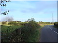
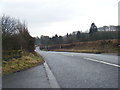
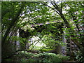
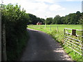
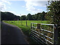
St. Fagans Community is a civil parish that forms part of the borough of Cardiff in Wales. The area covers a total land mass of 10.5 km², creating a compact community centred around significant historical landmarks. Life here revolves around St Fagans National Museum of History, an open-air institution established in 1948 on the grounds of the historic castle. Visitors explore over 40 relocated historic Welsh buildings, a Celtic village reconstruction, and the site of the 1648 Battle of St Fagans. St Mary's Church, constructed around 1300 AD, stands as a testament to the parish's deep religious roots stemming from its Christian association since 180 AD. Living in St. Fagans offers daily access to 104 acres of woodland and the castle gardens, providing a green backdrop to resident life. The normas arrived in 1091, and the site subsequently passed through various families before the Plymouth ownership ended in 1946, leading to the donation of the castle and grounds for public use. For current residents, the area feels defined by this blend of educational heritage and natural space. You will find yourself walking among structures dating from prehistoric times to the Victorian era, with the museum offering shops and a tea room for local habitation needs. The parish identity remains strong, even as it functions within the modern administrative framework of Cardiff. The historic narrative, from the arrival of St Fagan to the emotive site of the Civil War battle, permeates the local atmosphere.
- Area Type
- Parish
- Area Size
- 10.5 km²
- Population
- Not available
- Population Density
- Not available
Demographics
The community in St. Fagans displays a distinctly older population profile compared to many urban centres in Wales. The median age for residents is 70, indicating that the area is home to a large proportion of elderly people. This demographic reality shapes the daily rhythm of life, with services and amenities likely catering to the needs of mature residents. Notably, home ownership rates are very high within the parish, standing at 84 per cent of all households. This figure confirms that the vast majority of people living in St. Fagans Community have purchased their properties outright or hold a mortgage, rather than renting. Such a high level of tenure suggests a long-term commitment to the location and financial stability among residents. The data does not specify a single most common age breakdown beyond the total age range, but the median confirms an ageing cohort. Household composition details are not broken down by specific family types in the available records, though the high ownership rate often correlates with families with children or empty nesters seeking settled environments. There is no specific data provided on the predominant ethnic group or religious affiliations within this parish in the current records. You should expect a demographic environment that is stable and rooted, where long-term residency is the norm. The concentration of older homeowners creates a quiet, established tone that distinguishes St. Fagans from more transient rental markets found in other parts of Cardiff.
Household Size
Accommodation Type
Tenure
Ethnic Group
Religion
Household Composition
Age
Household Deprivation
NS-SEC
Explore more demographic insights in this area
Go to Demographics tabPlanning
Planning Constraints
- Flood RiskPremium
- Ramsar Wetland SitesPremium
- Area of Outstanding Natural BeautyPremium
- Protected Nature ReservePremium
- Protected WoodlandPremium
- Crime RiskPremium